Around the earth axis town


- 4:13 h
- 16.38 km
- 230 m
- 229 m
- 409 m
- 500 m
- 91 m
- Start: Pausa market (hiking sign in front of the town hall)
- Destination: Pausa market (hiking sign in front of the town hall)
Section 1 of the path about 8.5 km with a walking time of about 2.5 h
Section 2 with 16.5 km with a walking time of up to 4.5 h
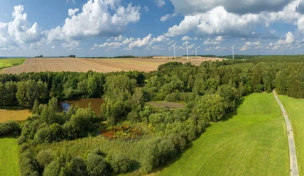
The path mainly leads over paved forest and field paths and along the road
Waypoints

Good to know
Best to visit
Directions
Route: 8.5 km Pausa Market - Unterreichenau - Pöhl - Bad Linda - Linda - Berghübel - Pausa outdoor pool - Pausa (Market);
Route: 16.5 km Pausa (Market) - Ebersgrün - Upper Kalkgrube - Historical Ländereck - Black Pond - Pond Path - Spitzburg junction - Wallengrün - Jahnberg - Pöhl - Bad Linda - Linda - Berghübel - Pausa outdoor pool - Pausa (Market)
Tour information
Cultural Interesting
Loop Road
Stop at an Inn
Directions & Parking facilities
A9 exit Triptis: direction Zeulenroda, from Zeulenroda on S 316 to Pausa;
A9 exit Schleiz: direction Plauen B 282 to Waldfrieden, S 318 via Ranspach to Pausa or continue on B 282 to Oberpirk, left on S 316 to Pausa;
A72 exit Plauen: Plauen B 282 towards Schleiz up to Oberpirk junction, right on S 316 to Pausa.
Additional information
Pausa Information Tel: 037432 60314
Places to eat
Grünes Tal Tel: 03742 22696
Am Markt Tel: 037432 20312
Am Freibad 037432 50303
Zur Linde 037432 20595
Links
Author
Vogtland - Sinfonie der Natur
Organization
Vogtland - Sinfonie der Natur
License (master data)
Vogtland - Sinfonie der Natur

Author´s Tip / Recommendation of the author
Nearby


Download GPX file