- Photos & Map
How would you like to arrive?
- Description
- Good to know
- Nearby
Download GPX file
- 6:11 h
- 21.28 km
- 490 m
- 483 m
- 146 m
- 364 m
- 218 m
- Start: In the parking lot behind the shooting hall, Alter Dreschplatz (unlimited parking) From there, follow feeder road 5 until the junction with feeder road 4.
- Destination: You return to the same starting point.
From the public parking lot behind the Blomberg shooting range, the route leads out of town on feeder road 5 of the Nelkenweg in an easterly direction through and past various residential areas. Over the last 50 years, the town has expanded far into the countryside. The route can be completed in both directions, the following route is described as an anti-clockwise route.
The ascent to the Bunerberg offers a first viewpoint of the city. As the route continues, it crosses the country weirs between Blomberg and Siekholz several times. The feeder route 5 meets the Nelkenweg "N" and the Niedersachsenweg "X6" south of Siekholz at the Stammhof. Following the latter, the Schiederan district of Glashütte lies on the steep path up to Herlingsburg Castle. It is always worth walking around the Iron Age ramparts, especially as there is a refuge here with an impressive view. The route continues along the border between Lippe and Prussia. At the end of the loop, the Burgensteig takes over and leads along the eastern foot of the Winterberg to Eschenbruch along the edges of the forest with its many views.
From Eschenbruch, the route is almost completely wooded almost all the way to Blomberg. The Burgensteig trail initially leads the way. Following this, you will come across the relics of a Blomberg watchtower at Am Turm, located at the top of the pass on the district road between Blomberg and Eschenbruch. Worth seeing at this point, called Teufelei or Hölle, are the deeply cut hollow paths of the Hellweg.
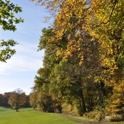
The route leaves the Burgensteig here and leads slightly downhill via feeder 3 of the Nelkenweg to the Blomberg forester's lodge. After a short ascent at the foot of the Eichenberg, the route continues past what are probably the oldest and mightiest beech trees in the Blomberg town forest to a botanical highlight, the semi-dry grassland on the western edge of the Eichenberg. Under ancient trees, a remnant from the time of forest grazing, there are views of the Blomberg basin and beyond.
After the steep climb to the top of the Eichenberg, a demonstration area is set up further on. Here, a forest that has died as a result of climate change is allowed to regenerate without human intervention. Downhill around the Bunerberg on the forest path takes over the feeder 4 of the Nelkenweg and leads back to the starting point.
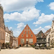
From here, the historic town center of Blomberg is very close by. A stroll through the medieval alleyways and a stop at the local restaurants is always worthwhile.
Good to know
Best to visit
suitable
Depends on weather
Tour information
Loop Road
Nature Highlight
Stop at an Inn
Tour with Dog
Author
Lippe Tourismus & Marketing GmbH
Grotenburg 52
32760 Detmold
License (master data)
Lippe Tourismus & Marketing GmbH
Nearby


