Burbach-Köllertal loop


- 2:40 h
- 36.14 km
- 353 m
- 382 m
- 186 m
- 362 m
- 176 m
- Start: Bike and hiking parking lot at the Burbach forest pond
- Destination: Bike and hiking parking lot at the Burbach forest pond
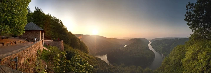
Three attractive valleys, the Saar, the Köller, and the Burbach valleys, as well as the ridges with distant views between them, characterize the all-day bike ride. A special highlight is the Völklinger Hütte World Heritage Site located directly on the route.
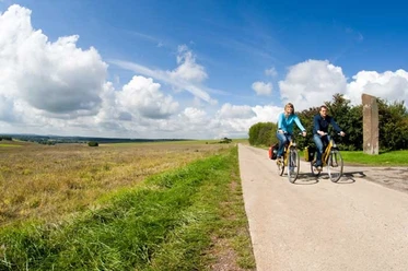
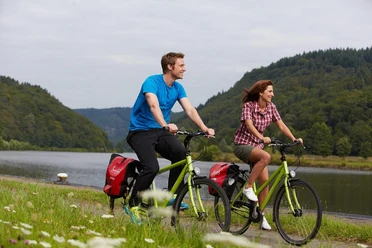
Route: Burbach forest pond - Burbach valley - outskirts of Riegelsberg - Ritterstraße - Engelfangen - Köllertal - Walpershofen - Schwalbach-Elm - Wackenmühle - Köllertal - Völklingen - Völklinger Hütte World Heritage Site - Saar cycle path - Europabrücke - Burbach - Burbach forest pond
This route is not marked with its own logo.
Start towards Riegelsberg. Below Von-der-Heyt, follow the orange-red signage of the Velovisavis main route into the Köllertal. From Köllerbach, follow the Köllertal cycle path with the green Saarland logo. In Walpershofen, switch to the Velo visavis route towards Schwalbach-Elm. Before the Wackenmühle, follow the Velo visavis main route again. From the Wackenmühle, follow the Köllertal cycle path to Völklingen. After crossing the Saar, follow the Saar cycle path with the blue Saarland logo. At the height of the former Burbach hut, turn right, pass under the motorway, and follow the signage to Burbach.
Good to know
Best to visit
Tour information
Cultural Interesting
Loop Road
Loop Road
Stop at an Inn
Organization
Saarland
License (master data)

Nearby
Download GPX file