


- 1:15 h
- 4.94 km
- 54 m
- 54 m
- 596 m
- 648 m
- 52 m
- Start: Hiking signpost in the village center
- Destination: Hiking signpost in the village center
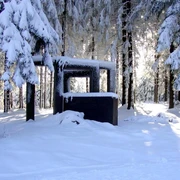
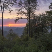
Scenic hike around the large Heidkopf with beautiful views of Schmallenberg, Fleckenberg, into the Uentroptal, up to Hawerland and to Huau.
Good to know
Best to visit
Directions
Always follow the hiking sign J3.
At first, the path leads out of the village along the road. You walk along a very beautiful trail beside the road until you reach a shelter. There, turn left and after a short time turn right again. Now the path leads with a good view around the large Heidkopf. When you meet the starting point of the circuit again, turn right after a few meters. The path takes you back to Jagdhaus. At the meadow with the shelter, go straight ahead and take the next path on the left. This leads you back into the village.
Tour information
Loop Road
Equipment
We recommend sturdy footwear as well as bringing enough food and drinks.
Directions & Parking facilities
At the intersection in Fleckenberg, turn off the B236 towards Jagdhaus.
Parking is available at the Jagdhaus hiking parking lot (coming from Fleckenberg at the edge of the village).
In Jagdhaus, bus line 466 runs, as well as the Schmallenberger Sauerland hiking bus (closed on Mondays, check the timetable).
Timetable information: www.rlg-online.de
With the Schmallenberger Sauerland Card, you can ride for free regionally on the hiking bus and public buses.
Additional information
For refreshments after your tour, the Hotel Jagdhaus-Wiese, the Schäferhof, and the Gasthaus Tröster in Jagdhaus are recommended.
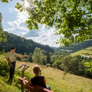
During the circuit, many benches invite you to rest and enjoy the beautiful views.
Author
Schmallenberger Sauerland Tourismus e.V.
Organization
Schmallenberger Sauerland Tourismus
License (master data)

Author´s Tip / Recommendation of the author
In summer (depending on the weather approximately June & July) foxglove blooms along the route.
Safety guidelines
A rescue point system is established in Hochsauerlandkreis. Rescue points can be found, among other places, on the information boards at junctions and hiking signs.
Map
Nearby