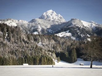
Demanding snowshoe route from Osterhofen to Wendelstein and to Bayrischzell


- 5:00 h
- 11.93 km
- 876 m
- 878 m
- 803 m
- 1,681 m
- 878 m
- Start: Osterhofen
- Destination: Bayrischzell town center
The route leads over Hochkreuth up to the Wendelstein Alm. From there, after a break with a fantastic view, it goes up to the Kesselwand and then down via the lower Sudelfeld to Bayrischzell. Along the way, there are numerous places to stop for refreshments.
Good to know
Best to visit
suitable
Depends on weather
Tour information
Stop at an Inn
Summit
Author
Regionalentwicklung Oberland
Organization
Alpenregion Tegernsee Schliersee
License (master data)

Nearby