From Geitau to the Rotwand

- 8:00 h
- 18.71 km
- 1,162 m
- 1,161 m
- 785 m
- 1,885 m
- 1,100 m
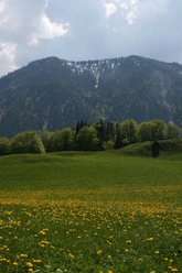
- Start: Hiking parking lot Bayrischzell-Geitau
- Destination: Hiking parking lot Bayrischzell-Geitau
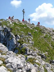
Our path to the Rotwand leads us initially from Geitau over paved paths, then along forest roads until we finally reach alpine trails. At the top, a wonderful view awaits us as far as Munich. Stopping at the Rotwandhaus is also recommended.
Good to know
Best to visit
- suitableDepends on weather
Tour information
Loop Road
Loop Road
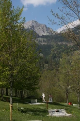
Stop at an Inn
Summit
Author
Regionalentwicklung Oberland
Organization
Alpenregion Tegernsee Schliersee
License (master data)

Nearby
Download GPX file