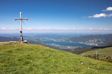
From Lenggries Mühlbach via Seekarkreuz to Tegernsee


- 8:00 h
- 19.84 km
- 924 m
- 910 m
- 718 m
- 1,597 m
- 879 m
- Start: Lenggries Mühlbach parking lot
- Destination: Center of Bad Wiessee
The route is very popular with a high proportion of forest trails. The path from valley to valley with a summit in between makes the hike exciting and varied.
Good to know
Best to visit
suitable
Depends on weather
Tour information
Stop at an Inn
Summit
Author
Regionalentwicklung Oberland
Organization
Alpenregion Tegernsee Schliersee
License (master data)

Nearby

