From Spitzingsee to the Bodenschneid


- 3:15 h
- 8.69 km
- 646 m
- 646 m
- 1,106 m
- 1,655 m
- 549 m
- Start: Spitzingsee car park Kurvenlift
- Destination: Spitzingsee car park Kurvenlift
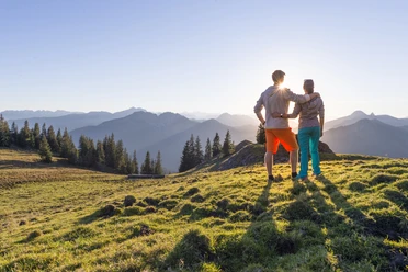
From the wide forest road to the rocky path, you will walk on almost all types of trails on this route. Technically, the hike is graded as moderate, but increased caution is advised when wet, especially in areas where the path runs over rock.
Good to know
Best to visit
suitable
Depends on weather
Tour information
Stop at an Inn
Author
Regionalentwicklung Oberland
Organization
Alpenregion Tegernsee Schliersee
License (master data)

Nearby