From Spitzingsee to the Rotwand

- 8:00 h
- 19.44 km
- 1,067 m
- 1,067 m
- 938 m
- 1,878 m
- 940 m
- Start: Taubenstein cable car parking
- Destination: Taubenstein cable car parking
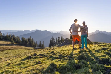
With a high proportion of trails, this very varied hike takes us to the highest peak of the Spitzingsee region. It offers many places to stop, and for families a shortcut with the cable car is possible, or it can also be divided into two stages by spending a night in a hut: either at the Schönfeldhütte, the Taubensteinhaus, or the Rotwandhaus.
Good to know
Best to visit
suitable
Depends on weather
Tour information
Loop Road
Loop Road
Stop at an Inn
Summit
Author
Regionalentwicklung Oberland
Organization
Alpenregion Tegernsee Schliersee
License (master data)

Nearby

Download GPX file