- Photos & Map
How would you like to arrive?
- Description
- Good to know
- Nearby
- 5:00 h
- 19.07 km
- 102 m
- 113 m
- 111 m
- 183 m
- 72 m
- Start: Beucha station
- Destination: Wurzen station
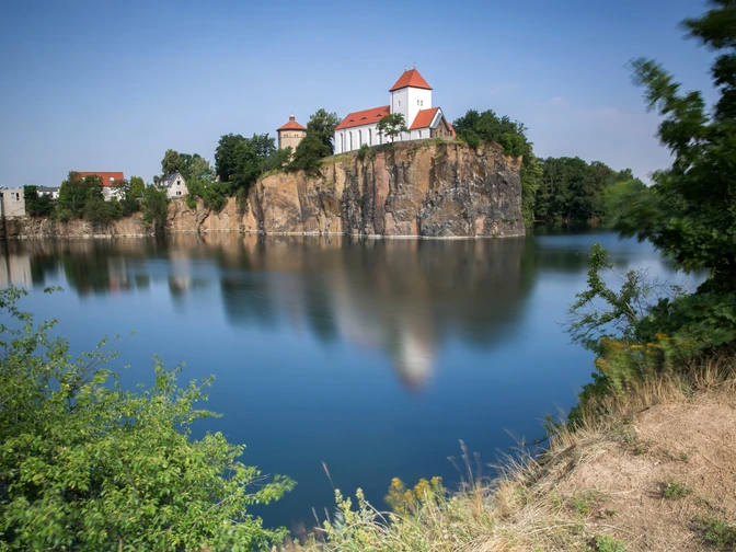
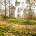
On the route from Beucha to Wurzen, hikers pass through the Brandiser Forest and the Planitz Forest. Several steep quarries and historical sites become visible. On the last section, between Schmöllen and Dehnitz, a ferry crosses over.
Good to know
Pavements
Unknown
Street
Asphalt
Gravel
Trail
Path
Best to visit
suitable
Depends on weather
Directions
The route starts at the train station in Beucha, behind you lies the Kirchbruch Beucha. The path leads you to the place Waldsteinberg past the Westbruch. From the Westbruch, it goes along the ridge path to the Ostbruch. Further through the Brandiser Forest, you continue the hike via the forest path and ring path and finally take the path Am Teich to Polenz. Along Altenhainer Straße, you walk into the Planitz Forest. In the Planitz Forest, keep northeast direction towards Schmöllen. In the Planitz Forest, at a six-way junction and a four-way junction, continue straight. In Schmöllen, take the Ruffähre ferry across the Mulde River to Dehnitz. In Dehnitz, the bike path leads you over the Mühlbach and finally along Straße am Wachtelberg and Dehnitzer Weg into the town of Wurzen.
Equipment
Sturdy footwear, weatherproof clothing and provisions
Directions & Parking facilities
By car: From the A14 take exit 29 (Naunhof), then continue towards Brandis/Waldsteinberg.
Beucha: Albert-Kuntz-Straße
Wurzen: Am Bahnhof
- Train: Beucha station
- S-train station: Wurzen
Additional information
Ruffähre Dehnitz, Tel. +49 (0)3425 811555
- March-Oct: Tue-Sun: 11 am-8 pm
- Nov-Feb: Wed-Sun: 11 am-8 pm
Author
Verena Daser
Organization
LEIPZIG REGION
License (master data)
Author´s Tip / Recommendation of the author
- Bergkirche Beucha
- Ev.-Luth. town church Brandis with Donat organ
- Bismarck Tower on Wachtelberg
- Cultural History Museum Wurzen with Ringelnatz collection
Safety guidelines
The hiking trail crosses a railway line that is used by rail traffic once a week. There is no official crossing at this location; use of the trail is at your own risk.
Nearby
