Hike to the lookout mountain Hochwald in the Zittau Mountains Nature Park

8.12 km long
Round trip
Difficulty: medium
Condition: easy
Great panorama
Hiking
  • 2:40 h
  • 8.12 km
  • 387 m
  • 387 m
  • 395 m
  • 735 m
  • 340 m
  • Start: Spa town Oybin, Haus des Gastes
  • Destination: Spa town Oybin, narrow gauge railway station
From the center of the spa town of Oybin to the second highest lookout mountain in the Zittau Mountains – a varied circular hike with a unique three-country panoramic view.

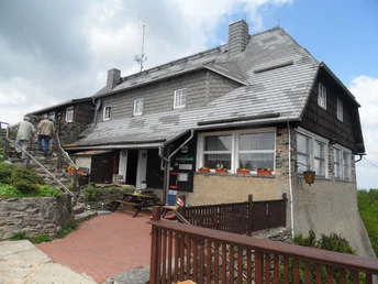
On the 8 km long circular route, the experience of the landscape is combined with getting to know the idyllic spa town. The route partly leads along the border with the Czech Republic. The Hochwald offers a magnificent view of the Lusatian Mountains and the Jizera Mountains. There are dining options in the mountain huts on the Hochwald. The ascent to the Hochwald tower is possible all year round.

Good to know

Pavements

Street
Asphalt
Gravel
Trail
Path

Best to visit

suitable
Depends on weather

Directions

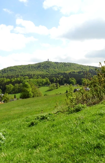
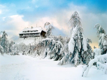
The Hochwald is, at 749 m, the second highest lookout mountain in the Zittau Mountains. It is characterized by a north and south summit. The border with the Czech Republic runs across the lookout plateau. The starting point of the hike is the Haus des Gastes in the center of the spa town of Oybin. The path (yellow line) leads uphill through the village along the old main road up to the “Parkhotel” Oybin. From here, it goes via the old Hainstraße to the Hain district. Following the street, you reach the border crossing at the Kammbaude. Passing the Hochwaldhof, you reach the summit region via the Hochwaldweg (yellow dot) after short, steep climbs. The Hochwaldbaude comes into view. From its viewing plateau, you can enjoy a view of the Bohemian Central Mountains and the Jizera and Giant Mountains in good visibility conditions.

The path (blue line/Upper Lusatian Mountain Trail) leads north to the Hochwald tower with the tower hut. On this path lies the junction for the descent. From the tower, there is a magnificent panoramic view of the entire surroundings. The descent from the Hochwald (blue line) leads in the direction of Lückendorf to the Kammloch. The road at the Kammloch is crossed. The path (yellow dot) leads in the direction of the Felsengasse up to the Fürstensteig. From here, the descent continues on the Fürstensteig to Oybin town center (yellow line), passing the rock formations Rosensteine. A detour to the Kelchstein is worthwhile.

Tour information

  • Loop Road

  • Stop at an Inn

  • Summit

Equipment

Sturdy footwear recommended

Directions & Parking facilities

From Zittau on the S133 to Oybin


Paid parking in the town center
From Zittau to Oybin by narrow gauge railway or bus line 6


Additional information

Bergpass leaflet – The most beautiful mountain hiking destinations of southern Upper Lusatia

Author

Marketing-Gesellschaft Oberlausitz-Niederschlesien mbH

Organization

Das Landschaftswunderland Oberlausitz

License (master data)

Marketing-Gesellschaft Oberlausitz-Niederschlesien mbH
License: Attribution, ShareAlike

Author´s Tip / Recommendation of the author

Recommended: Border route to the Czech Republic over the mountain summit, tower climb on the Hochwald, detour to the Kelchsteine (noteworthy rock formations).

Safety guidelines

Carry your ID card

Map

Zittau Mountains, No. 39, ISBN 978-3-86843-039-4

Nearby

Contact

Hike to the lookout mountain Hochwald in the Zittau Mountains Nature Park
02797 Oybin