- 0:35 h
- 1.60 km
- 92 m
- 34 m
- 211 m
- 301 m
- 90 m
- Start: Burg Altena
- Destination: Burg Altena
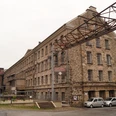
The beginning of the path is opposite Altena castle and it leads to the circular Altenaer Höhen route. The first part of the educational trail will inform you about the Altena castle, the German Youth Hotel Association that was set up in Altena as well as about the development of Altena with its wire and metal industry.
The further you walk into the wood, the information will focus on that wood. Plaques on the side of the road introduce the forest inhabitants and if you're lucky you will actually see one or more of them.
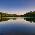
You will also pass a forest tipi and a mythical well. You might even forget about the Steinsbörnchen, about which you will have learned more during the exciting ride with the adventure elevator to the Altena castle. The end of the circular route is at the green classroom where you can sit down, enjoy the beautiful view of hilly Altena and that provides interesting information regarding flora, fauna and environmental protection on various plaques and signs.
Good to know
Pavements
Best to visit
Directions
Tour information
Cultural Interesting
Loop Road
Stop at an Inn
Equipment
Directions & Parking facilities
Von der Autobahn A45 (Sauerlandlinie) fahren Sie an der Ausfahrt Lüdenscheid-Nord ab und folgen dann der Beschilderung nach Altena.
Von der A46 nehmen Sie die Ausfahrt Iserlohn-Oestrich und folgen dann den Schildern nach Altena.
Additional information
Stadt Altena (Westf.)
Tel. 02352 3370944
tourismus@altena.de
www.visitaltena.de
Author
Melanie Spelsberg
Organization
Märkischer Kreis
License (master data)
Melanie Spelsberg

Author´s Tip / Recommendation of the author
Nearby