Kamenz-Stolpen


- 12:05 h
- 47.88 km
- 540 m
- 409 m
- 179 m
- 415 m
- 236 m
- Start: Kamenz train station
- Destination: Kirnitzschtal in Saxon Switzerland
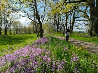
The hiking route has existed since the 1990s and is a north-south connection between the Lessing town of Kamenz and the Saxon Switzerland up to the Kirnitzschtal.
Waypoints
Start
Destination
Good to know
Pavements
- Street (13%)Asphalt (20%)Gravel (23%)Trail (35%)Path (8%)
Best to visit
- suitableDepends on weather
Directions
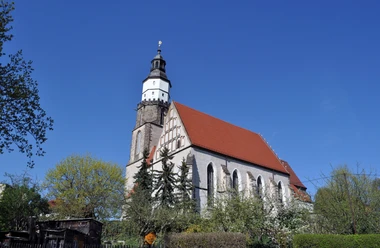
- Kamenz train station - Kamenz town centre - Herrental - Gickelsberg - Eselsburg - Hennersdorf - Gersdorf - Bischheim - Weißbach - Niedersteina - Obersteina - Schwedenstein - Pulsnitz town forest - Pulsnitz town centre - Großröhrsdorf - Massenei forest area - Arnsdorf - Fischbach - Schwarzes Roß - Karswald - Rennersdorf-Neudörfel - Stolpen town centre
Tour information
Cultural Interesting
Stop at an Inn
Directions & Parking facilities
Author
Region Westlausitz
Organization
Das Landschaftswunderland Oberlausitz
License (master data)
Region Westlausitz

Map
Sachsenkartographie - "Hiking and Cycling Map West Lusatia", 1:33,000, ISBN 978-3-86843-018-9
Dr. Barthel Verlag - "Cycling and Hiking Map Bischofswerda, Pulsnitz, Stolpen and surroundings", 1:35,000; ISBN 978-3-89591-144-6


