Mountain Meadows Trail in Winterberg


- 1:00 h
- 3.05 km
- 50 m
- 50 m
- 667 m
- 713 m
- 46 m
- Start: Hiking parking lot at the radio tower (corner Kreuzbergweg/Am Rad)
- Destination: Hiking parking lot at the radio tower (corner Kreuzbergweg/Am Rad)
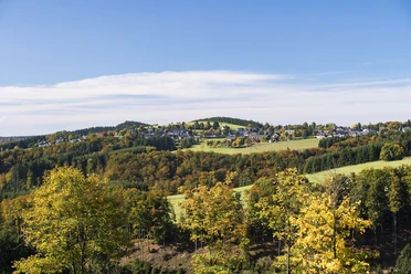
Along the Kreuzberg, you experience a landscape that has become increasingly rare or is even threatened with disappearance due to changes in agriculture – species-rich mountain meadows and pastures. The colorful mountain meadows, called "Goldhaferwiesen," are something very special. In their characteristic composition with all the mountain herbs, they can only be found in North Rhine-Westphalia in the highlands of the Eifel and Sauerland. Together with local farmers and horse owners, the LIFE project “Mountain Meadows near Winterberg” gives them another chance.
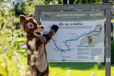
Along the path, information boards at seven stations invite you to learn more about the diverse habitats, their historical use, and the measures of the LIFE project.
The bloom brilliance of the mountain meadows unfolds especially splendidly from mid-May to the mowing in July. Then at Kreuzberg, cranesbill, bistort, and co. compete with the sun in shining. But even during the hay harvest, the post-bloom, and in Indian summer, the meadow landscape offers much to see well into autumn. The jewel of the Winterberg mountain meadows, the gold-orange shining Dukatenfalter butterfly, can also be observed here. For butterflies, grasshoppers, and many other animals, the flower-rich mountain meadows and pastures are a true paradise.
Good to know
Best to visit
Tour information
Loop Road
Loop Road
Author
Ronja Henke
Organization
Ferienwelt Winterberg
License (master data)

Nearby

Download GPX file