- Photos & Map
How would you like to arrive?
- Description
- Good to know
- Nearby
Download GPX file
- 2:40 h
- 38.64 km
- 162 m
- 162 m
- 123 m
- 241 m
- 118 m
- Start: Wermsdorf
- Destination: Wermsdorf
The cycle paths in the Wermsdorf Forest are both idyllic and interesting, a large, continuous forest area that offers nature lovers space and quiet, thus providing the best opportunities for relaxation. Between the towns of Wermsdorf and Oschatz, the Mulde-Elbe cycle route runs over an area characterized by numerous ponds, extensive meadows, and fertile fields on gently rolling to flat land. The only prominent elevation is the Collmberg, which rises almost one hundred meters above the surroundings.
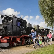
To ease the journey, more than half of the Döllnitztal cycle route, which connects the two towns via the southern cycle path, can be completed by train. The Döllnitzbahn, a narrow-gauge railway colloquially known as "Wilder Robert," shuttles between Oschatz, Mügeln, and Glossen.
More about cycle routes in the Leipzig region: www.leipzig.travel/radfahren
Good to know
Pavements
Best to visit
Directions
Döllnitztal cycle route:
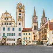
Cycle tourists can choose the start of the route in Wermsdorf at two places. One starting point is the town center, the other is at Horstsee. In Wermsdorf, visiting Hubertusburg Castle as a notable landmark is recommended.
After the town of Glossen, there is the first opportunity to pause or alter the trip by boarding the Döllnitzbahn, a narrow-gauge railway colloquially called "Wilder Robert." The train shuttles between Oschatz and Mügeln, with once daily the possibility to continue to Kemmlitz. The town is known for its kaolin pit, the raw material for the famous Meissen porcelain. The "Wilder Robert" runs parallel to the intermediate and final stretch of the cycle path to Oschatz. Thus, one can continue to board the narrow-gauge railway. The stops are easily reachable according to the map, though slightly off the actual cycle path.
Side route Nebitzschen - Collm: The side route (about 8 km) should only be chosen in good weather and good visibility. The ride to Collm requires a lot of stamina because the path goes up and down. The Collm is a widely visible landmark with its height of 312 meters and a relative height between 100 and 150 meters compared to its flat surroundings.
Tour information
Loop Road
Stop at an Inn
Equipment
Bicycle helmet, rain and sun protection, provisions and water, bicycle lighting in darkness.
Directions & Parking facilities
Reachable by car from Leipzig via the A14 and S38.
Wermsdorf: Friedhofstraße / Clara-Zetkin-Straße
Oschatz: O-Schatz-Park / Freiherr vom Stein Promenade
Take the RE50 (towards Dresden Hbf) to Oschatz station.
Additional information
More about cycle routes in the Leipzig region:www.leipzig.travel/radfahren
Author
Christina Witt
Organization
LEIPZIG REGION
License (master data)
Author´s Tip / Recommendation of the author
E-bike charging stations:
Oschatz: Altmarkt (Sporerstraße 16)
Nearby


