- 6:00 h
- 18.78 km
- 509 m
- 511 m
- 92 m
- 330 m
- 238 m
- Start: train station Herchen
- Destination: train station Herchen
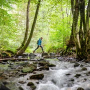
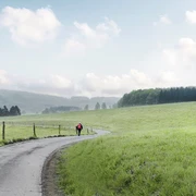
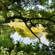
Around the pretty health resort of Herchen you will find everything you need for an eventful hike: springs, streams, biotopes and a trip into history. One section leads over wider forest paths - overall there are beautiful forest and meadow paths!
Good to know
Best to visit
Directions
©W&A Marketing & Verlag GmbH
Tour information
Loop Road
Equipment
Directions & Parking facilities
Additional information
All stages of the Natursteig Sieg lead from station to station and are completely marked with the blue Natursteig Sieg logo in both directions. The access routes to the quality hosts, town centers and train stations are marked in yellow. You can find displays with overview maps and further information about places to stop for refreshments and overnight stays as well as sights at the train stations and at the starting points of the stages.
Literature
Author
Naturregion Sieg
Organization
Rhein-Sieg Tourismus
License (master data)

Author´s Tip / Recommendation of the author
Map
Nearby