Oberland bike route


- 1:01 h
- 13.64 km
- 128 m
- 100 m
- 410 m
- 514 m
- 104 m
- Start: Schleiz
- Destination: Saalburg
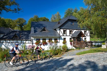
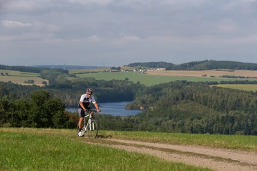
On the former railway line between Schleiz and Saalburg, a perfectly asphalted bike path was created in 2010. And this bike path is different. The curves are never too tight and the route is dam-like reinforced. Like on a viewing platform, you float through meadows and forests. Magnificent views allow a unique sight of the fjord-like landscape of the Thuringian Sea located in the valley.
The Oberland bike route starts at the Red Bridge in Schleiz and ends with a spectacular view over Germany's largest reservoir in Saalburg. The bike path is suitable for numerous activities. It invites hiking, jogging, inline skating or walking. The Oberland bike route is a part of the Euregio-Egrensis long-distance cycle route from Bavaria via Thuringia and Saxony to Bohemia. One of the most scenic and varied river bike routes in Germany, the Saale bike path, can also be ridden from the Burgk Saale junction downriver or towards Saalburg.
Waypoints

Good to know
Pavements
- Unknown (12%)Asphalt (82%)Gravel (4%)Trail (2%)
Best to visit
- suitableDepends on weather
Directions & Parking facilities
- Getting thereTake the Schleiz/Plauen exit on the A 9 motorway.Public transportation
Schleiz and Saalburg can be reached by regional bus. Information is available at https://www.kombus-online.eu
Additional information
Information about accommodations or leisure activities can be obtained from the Schleiz Tourist Information or at https://www.schleiz.de/tourismus-und-freizeit/stadtinformation/schleiz-auf-dem-rad
Author
Tourismus Marketing Gesellschaft Sachsen mbH
Bautzner Straße 45/4701099 DresdenOrganization
Vogtland - Sinfonie der Natur
License (master data)
Vogtland - Sinfonie der Natur

Author´s Tip / Recommendation of the author
- A detour to Burgk Castle should definitely be made.