Over water and land to the Schloßhalbinsel


- 2:30 h
- 17.13 km
- 32 m
- 62 m
- 366 m
- 407 m
- 41 m
- Start: Wassersportzentrum car park
- Destination: Wassersportzentrum car park
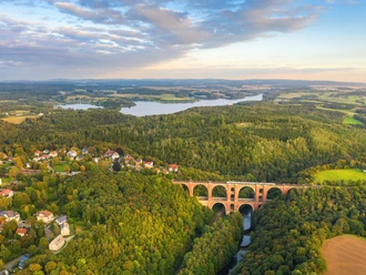
After an eventful boat trip over the Talsperre Pöhl from the landing stage near the dam, the ship docks after about 45 minutes at the lawn Schloßhalbinsel. There the actual six-kilometer hike begins along the idyllic reservoir shore back to the starting point.
The route is a section of the yellow-marked reservoir circular trail, which impresses with its great views of the Talsperre Pöhl. During the route, there are dining options and some highlights of Talsperre Pöhl to discover, such as the leisure and adventure garden and the impressive dam.
Waypoints
Start


Good to know
Pavements
Street (3%)
Asphalt (6%)
Gravel (5%)
Trail (15%)
Path (10%)
Ferry (61%)
Best to visit
suitable
Depends on weather
Tour information
Loop Road
Loop Road
Stop at an Inn
Author
Tourismus Marketing Gesellschaft Sachsen mbH
Bautzner Straße 45/47
01099 Dresden
Organization
Zweckverband Talsperre Pöhl
License (master data)
Zweckverband Talsperre Pöhl

Nearby


Download GPX file