


- 3:15 h
- 11.31 km
- 238 m
- 235 m
- 202 m
- 350 m
- 148 m
- Start: Hikers' parking lot at the small viaduct in the Dune Valley
- Destination: Hikers' parking lot at the small viaduct in the Dune Valley
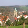
Following the orange signs for the Paderborn High Trail to the left, you will reach Paderborn's highest point (347 m above sea level) after just under three kilometers and another hundred meters of ascent. A "summit cross" - with a summit book! - clearly marks the spot. The path runs through the "Mittelholz", first past the "beech tree with two legs", then past the plague cemetery back towards Neuenbeken - always with beautiful views of the village.
At the crossroads after the mausoleum of the Uhden glassmaking family, the trail continues towards Glashütte, now on the crossroads marked with blue signs, on which the viewing platform is reached again after a good kilometer. From here, it is only a few minutes to the hiking parking lot in the Dune Valley.The Paderborn High Trail was certified by the German Hiking Association in 2014, 2017 and 2020 as a "Quality Trail Wanderbares Deutschland"!

Good to know
Pavements
Best to visit
Directions
From the parking lot at the mountain hut, follow the path to the right behind the hut and hike up the slope in a few hairpin bends. We now have around 50 meters of altitude to overcome. At the top, we come to a junction where we can choose between three other paths.
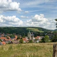
After a few minutes, we turn right along the crossroads marked with blue signposts and reach the viewing platform built in 2014, which offers an impressive view of the viaduct and over the Beketal valley.
To continue our hike on the main path, we turn left and follow the gravel path, which runs along the slope at roughly the same level. After about 10 minutes, after a left-hand bend, we come to a junction where we have three options. We opt for the middle path, which continues along the slope at roughly the same altitude. After about 250 meters, we follow the bend to the right and then hike slightly uphill into a side valley of the Dune Valley. About 100 meters after a left-hand bend, we come to a fork where we decide to take the right-hand, uphill path. We turn left at a T-junction. We walk steadily uphill and reach a hill. The beech forest ends and we now walk through a section of forest where spruce trees used to grow, which were felled due to bark beetle infestation. At the end of the former forest, at a T-junction, we keep to the right. We walk towards the wind turbines and reach the edge of the forest, where we see a red and white barrier and a raised hide. Where the asphalt path begins, we turn right and continue along the edge of the former spruce forest. After a good 100 meters, we walk straight into the "forest" and stay on the wide forest path for about 200 meters. Then we leave it by turning left into the former spruce forest. Now we can already see the summit cross, which marks the highest point in Paderborn, 347 meters above sea level. A metal box containing the summit book is attached to the overview board. Two forest sofas and a picnic area invite you to take a long rest here. An information board provides information about the future of the forest after the clear-cutting of spruce stands, which has taken place in many places - including here.
2nd stage: Highest point - plague cemetery: 3.2 km
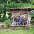
Shortly after the summit cross, we turn right and continue along a former logging trail through the former spruce forest. At the end, turn left. After a few meters, the ground changes to asphalt. At this point, we see a bench on the left and an information board on the use of wind energy on the Paderborn plateau. After about 200 meters on the asphalt path, before the slight ascent, we turn right onto a forest path. After about 100 meters, a path branches off to the left, which we follow through the forest. At the Karl Hagemeier hut of the Eggegebirgsverein Paderborn section, this path meets a well-maintained forest path, which we follow to the left, unless we want to take a break at the hut first.
At the T-junction, we turn right, but turn left again after around 100 meters. We walk slightly downhill on this forest path for a good 300 meters. Then we turn left onto a natural path. We now walk for almost three kilometers on the family version of the Paderborn High Trail. After about 300 meters on the nature trail, we pass the large climbing station, which was specially constructed for the family version. 150 meters further on, we come to a wide asphalt path. We turn right and after 60 meters reach a junction of two asphalt paths. There we turn slightly left onto a nature trail. We follow this for almost 500 meters and pass the animal call station. After crossing a logging road, our nature trail leads us directly past the "beech tree with two legs" and finally meets a wide gravel forest path directly at the "hut to the beech tree with two legs".
From there, we continue our hike to the left. Shortly afterwards, the forest path leads downhill before reaching a T-junction at the edge of the forest. We continue along the gravel path to the right. At the edge of the forest, the gravel path bends to the left. Here we turn right onto a forest path, but before doing so we should definitely enjoy the view of Bad Lippspringe, the Senne and the Teutoburg Forest. At the point where the path bends to the right, we keep slightly to the left and shortly afterwards see several yew trees, some upright stones, a memorial stone on the left and a 4.50 meter high oak cross a little further on. We have reached the plague cemetery, which was established here almost 400 years ago during the Thirty Years' War.
Stage 3: Plague cemetery - Uhden mausoleum: 2.2 km
We follow the path and reach a footpath, which we follow to the left. After just under 400 meters, we meet the wide asphalt path again, which we cross diagonally to the right. An information board at the small parking lot informs us that this is the official starting point of the family version of the Paderborn High Trail.
We enter the narrow footpath that winds its way through the beech forest. At the edge of the forest, we come to a gravel path, which we follow to the right. At this point, we again have a beautiful view of Neuenbeken, Benhausen and Bad Lippspringe as far as the Teutoburg Forest. There is a picnic area here where you can take a break.
We enter the forest and choose the left alternative at the fork. This gravel path initially runs parallel to the edge of the forest at a short distance, then leads into the forest and describes an ascending left-hand bend. At the crossroads, where there is a green high seat, we turn left and leave the family version of the Paderborn High Trail. We hike through an elongated right-hand bend, followed shortly afterwards by a slight left-hand bend. Flanked by bushes, we walk downhill on a beautiful path along the edge of the forest.
After around 300 meters, we leave our path by turning right onto a path. After a short ascent, this describes a 180-degree right-hand bend. We reach a T-junction and continue our tour to the left on the gravel path. There is now a wire mesh fence on the left. About 100 meters before the end of this path - we can already see a railroad bridge ahead of us - we branch off to the left onto a footpath at a fence with green metal posts and an information board about the mausoleum. We walk downhill, follow the bend to the right and after a few meters we reach the Uhden family mausoleum, which is made of limestone.
Stage 4: Uhden mausoleum - Dunetal: 2.2 km
We hike uphill on a gravel path, pass a passage in the fence and return to the path from which we turned off to the mausoleum. If we walk relatively straight across the crossroads into Glashüttenstraße, we reach the former Uhden glassworks after a few meters. The small half-timbered building on the left is a former bakery.
We follow the blue signposts along the railroad embankment. We pass a few gardens along the way. About 100 meters after a high-voltage power line, our asphalt path turns into a gravel path. At the fork immediately afterwards, we keep left and continue along the railroad embankment. Shortly afterwards, we enjoy a wonderful view over the Beketal valley towards Altenbeken. The path then turns right and leads slightly downhill into a side valley of the Beketal, where it bends to the left. The path then climbs back up towards the railroad tracks. At the fork after the right-hand bend, we take the gravel path that branches off to the right and leads uphill. A few minutes later, we reach the viewing platform and walk down the familiar hairpin bends to the parking lot at the Dune Valley refuge.
Tour information
Loop Road
Premium Trail "Wanderbares Deutschland"
Equipment
Directions & Parking facilities
The regional bus 452 connects Neuenbeken with Altenbeken and Bad Lippspringe. The destination stop is "Kleiner Viadukt" for the starting point "Dunetal".
Further information on how to get there with the regional bus is available at www.fahr-mit.de or by phone on 05251 2930400.
Additional information
Königsplatz 10
33098 Paderborn
Tel. 05251 8812980
tourist-info@paderborn.de
www.paderborn.de
www.facebook.com/paderborn.tourism
www.instagram.com/paderborn.tourismus
www.paderborner-hoehenweg.de
www.facebook.com/paderbornerhoehenweg
Literature
Pocket book "The most beautiful half-day hikes in the Paderborn region and Eggegebirge" with 20 interesting circular tours through the local region (220 pages). Available for 12.95 euros from Paderborn Tourist Information, bookshops (ISBN: 978-3-9809507-8-7) and - free of shipping costs - from HEFT-Zeitschriftenverlag (Tel. 05251 62624).
Author
Karl Heinz Schäfer
Organization
Tourist Information Paderborn / Verkehrsverein Paderborn e.V.
License (master data)
Karl Heinz Schäfer

Author´s Tip / Recommendation of the author
In early spring, while the beech forest is still bare of leaves, you can find large areas of wild garlic (Allium ursinum) in the Neuenbeken forest. The wild garlic, which is related to chives, onions and garlic, is valued as a wild vegetable, e.g. for soups, pesto or raw food. Collecting for private use is permitted. Take a cotton bag or similar with you!
By the way: Take a look at the Facebook page of the Paderborn High Trail: www.facebook.com/paderbornerhoehenweg
Map
Nearby