- Photos & Map
How would you like to arrive?
- Description
- Waypoints
- Good to know
- Nearby
Download GPX file
- 1:30 h
- 3.95 km
- 110 m
- 110 m
- 468 m
- 580 m
- 112 m
- Start: Bathing area Bad Elster
- Destination: Bathing area Bad Elster
Guests at Bad Elster can expect a charming environment with a well-signposted network of hiking trails. What is special, however, is that the hiking trails within the ring trail that completely surrounds Bad Elster were originally laid out at the end of the 19th century as terrain cure and thus practice paths.
Even back then, spa doctors had recognised that for sustainable cure success, passive therapy such as mud baths or drinking cures must be complemented by physical training through exercise. The beautiful forest-rich surroundings of Bad Elster with their varied terrain structure were ideal for this.
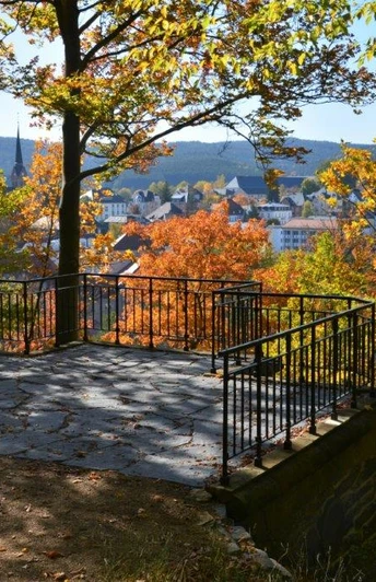
Like all terrain cure paths, this path also starts and ends in the centre of the spa. Due to Bad Elster’s location in a valley basin, it begins with a moderate incline, then runs level and finally through downhill terrain. Look forward to an enjoyable »training« round with a fantastic view of Bad Elster, idyllic quiet spots in the forest and a clearing full of culture!
Waypoints
Good to know
Pavements
Best to visit
Directions
At the bathing area Bad Elster between Marienquelle and Badecafé, there is a small pinetum (theme garden with various conifers) that you cross. Here you will come across a path leading uphill with a railing right at the foot of the Brunnenberg.
It is one of the many access points to the old terrain cure path system at Brunnenberg, which offers the special appeal of connecting the well-maintained park landscape directly with the natural forest area. This seemingly confusing path system is a further development of the promenades that were laid out on the slope of the Brunnenberg shortly after the foundation of the Royal Saxon State Spa in 1848. They offer the possibility to train with different levels of exertion. The natural terrain structure was used for this. Steeper slopes were mitigated, for example, by switchbacks. Higher levels of exertion could be achieved by stairs or steeper slopes.
Follow the path to the end of the railing and then, after about 50m, take the first switchback to the left. Use the path so that you reach the foot of the building you see nearby on the mountainside. It is a reservoir for the healing water of the Marienquelle. It was built to be independent of the outflow of the healing springs when dispensing the healing water baths at the Albert Bad.
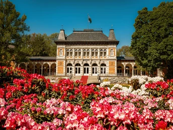
At the foot of the reservoir, the path goes uphill. Follow this and turn right at the next bend. This path will take you directly to the Holländerei - today a viewpoint where you have a beautiful view of the Royal Facilities, especially the Albert Bad, which lies directly below you here.
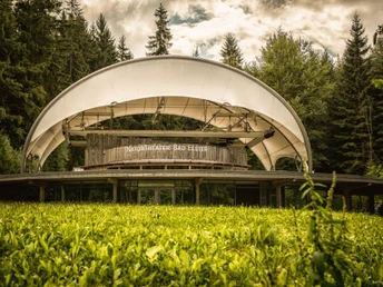
Continue straight on. It will lead you a short distance uphill to one of the huts at Brunnenberg, inviting hikers to rest in nature. It is the Eremitage. We continue exploring Brunnenberg at this junction on the steepest path, the Almweg (yellow cross). Watch out for the tempting rest area "Waidmannsruh" on the right of the path, which invites you to a short forest bath. Follow Almweg straight ahead until you meet Adorfer Weg. It is signposted and leads left through high forest. After a short time you will reach a wide forest road which you follow to the left. Walk this road straight on until you reach another beautiful shelter - the Albertihütte. At this crossroads the signage points you to the Mühlhausener Kirchsteig. It is an old path once used by residents of Mühlhausen assigned to Bad Elster to attend church. Follow this path to the left (green cross). The path leads downhill through high forest and you will reach the forest park with the NaturTheater and the restaurant "Waldquelle" directly.
Then take the path under the impressive light sculptures that welcome the guest to their visit to the NaturTheater, past the fitness and motor skills park. Here cross the Weiße Elster and after a few minutes you will again reach the Albert Bad and the bathing area.
Tour information
Cultural Interesting
Loop Road
Stop at an Inn
Tour with Dog
Directions & Parking facilities
Bad Elster can be reached from the A72 – Plauen South exit following B92 to the Bad Elster turnoff. From Bavaria you can alternatively take the A 93 to the Regnitzlosau exit. Drive towards Oelsnitz past the Saxon-Bavarian state border and turn right after Posseck towards Adorf. You finally reach Bad Elster via the B 92.
There are plenty of public parking spaces in Bad Elster (both paid and free) → info here: www.chursaechsische.de/besucherservice/anreise
Information about travel by bus and train is available from the Vogtland Tourism and Transport Office at 03744 / 19449 or www.vogtlandauskunft.de
You can reach Bad Elster by Vogtlandbahn. Information on schedules and fares is available at www.vogtlandbahn.de
or at the Vogtland Tourism and Transport Office at 03744 / 19449 or www.vogtlandauskunft.de
Additional information
Tourist information Bad Elster in the Royal Spa House
Phone 037437 53900
https://badelster.de/touristinformation
Event overview: https://chursaechsische.de/veranstaltungen/veranstaltungskalender
Various dining options are available in the Royal Facilities Bad Elster; the idyllic restaurant "Waldquelle" is directly on the path
Literature
Brochure » Genusswandern Bad Elster« The Royal Hiking Nature Paradise
Available at the tourist information office Bad Elster
Author
Vogtland - Sinfonie der Natur
Organization
Vogtland - Sinfonie der Natur
License (master data)
Author´s Tip / Recommendation of the author
Attend an event at the NaturTheater Bad Elster!
Include an additional training session at the fitness and motor skills park.
Map
Map of Bad Elster with all hiking trails by Verlag Dr. Barthel
ISBN: 978-3-89591-239-9
Hiking, ski and cycling map for the Vogtland Music and Spa Region, Bad Elster, Markneukirchen
ISBN: 978-3-89591-021-0
Available at the tourist information office Bad Elster
Nearby
