


- 2:55 h
- 10.71 km
- 240 m
- 224 m
- 324 m
- 553 m
- 229 m
- Start: Train station in Wilnsdorf-Rudersdorf
- Destination: Train station in Wilnsdorf-Rudersdorf
The hike begins with a ride through the longest railway tunnel in North Rhine-Westphalia. The double-track Rudersdorf tunnel is 2652 m long, has been in operation since 1915, and electrified since 1965. The Hessian part of the Rudersdorf tunnel is a cultural monument according to the Hessian Monument Protection Act. It penetrates the Tiefenrother Höhe (552.3 m) and thus the Rothaarsteig.
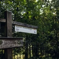
The Dill mountain route is marked with the black and white Rothaarsteig logo. On the main street in Dillbrecht you will find the marking, turn left, and follow the black and white logo towards the Lucas oak. At the first few meters, you go steeply uphill over meadows. The path and forest roads lead the way through varied forests uphill towards the Rothaarsteig, which you meet shortly before the Lucas oak. From there, continue over the Rothaarsteig marked with the red and white logo to the Hauberg trail. The typical Hauberg forestry for this region is presented here on a small educational trail. At the highest point, the "Nose in the Wind" offers a fantastic view over Siegerland. There you leave the Rothaarsteig and follow the access path marked with the yellow-black Rothaarsteig logo downhill to Rudersdorf. The access path leads to the station, the starting point of the hike.
This hike is 10.6 kilometers long, with 240 meters of elevation to overcome. At least three, rather three-and-a-half hours of hiking time should be planned. There are no places to eat along the way.
Good to know
Best to visit
Tour information
Loop Road
Loop Road
Author
Harald Knoche
Organization
Touristikverband Siegen-Wittgenstein e.V.
License (master data)

Nearby

