Public transport route: On the Rothaarsteig from Rodenbach to Dillenburg


- 6:15 h
- 21.98 km
- 465 m
- 580 m
- 224 m
- 447 m
- 223 m
- Start: Haiger-Dillbrecht station
- Destination: Dillenburg station
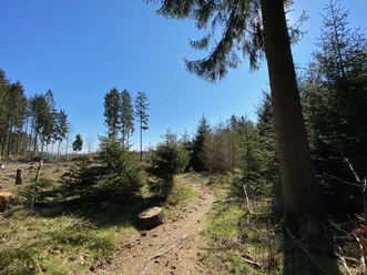
From the starting station Haiger-Dillbrecht, you hike along the yellow-marked Rothaarsteig access trail to the Lucaseiche. The approximately 220-year-old tree is protected as a natural monument and represents a special feature along the route. There, the Rothaarsteig access trail meets the main Rothaarsteig trail, which you now follow past the Steinbach forester's house through the town of Rodenbach. The hilltop east of the town invites you to take a break with its wide view. At a shelter, you can rest and then continue your way through Manderbach to Dillenburg. There, you will find a variety of well-preserved half-timbered houses in the old town. Not far from the old town is the Hofgarten, where the southern starting point of the Rothaarsteig is located.
If the approximately 21 kilometers are too long for you, you can also take the train only up to Rodenbach instead of Dillbrecht and start your hike from there. This shortens your route to about 13.8 kilometers.
Good to know
Best to visit
- suitableDepends on weather
Tour information
Familiy-Friendly
Good Connection to public Transport
Labelling
Premium Trail "Wanderbares Deutschland"
Stop at an Inn
Suitable for Winter
Tour with Dog
Contact person
Author
Organization
Rothaarsteigverein e. V.
License (master data)

