Röthelstein, Falkenstein reservoir and Rißfälle - Route 4 Beerheide


- 4:20 h
- 16.25 km
- 289 m
- 289 m
- 557 m
- 708 m
- 151 m
- Start: Hiking car park at the forest sports ground Beerheide
- Destination: Hiking car park at the forest sports ground Beerheide
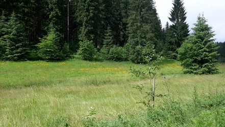
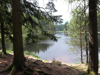
Very beautiful hiking route starting from the hiking car park in Beerheide down Rißweg II along the Rote Göltzsch to the double bridge. Further on Rißweg I sharp left uphill to the next crossroads. From here sharp right uphill to the left turnoff, over Stallmeisterberg to Juchhöhe. The path then leads right downhill on the street to Hanneloh. Now along Hammerbrücker Straße to the turnoff "An der Talsperre". Here you can take a break and recover from the first part of the hike. Your path then leads along the reservoir to Göltzschtalmühle, over Göltzschtalweg upstream to the Rißfällen. Here you can enjoy pure nature! Along the upper Floßgraben you now hike to Hammerbrücker Straße. From here your path leads on Grünbacher Straße to Falkensteiner Straße, from where you hike to Floßbahn and cross it. Continue up Rißweg II to your starting point the hiking car park.
Waypoints


Good to know
Best to visit
Tour information
Loop Road
Loop Road
Tour with Dog
Author
Claudia Gerisch
Organization
Vogtland - Sinfonie der Natur
License (master data)
Claudia Gerisch

Nearby


Download GPX file