- 1:35 h
- 4.92 km
- 200 m
- 128 m
- 485 m
- 645 m
- 160 m
- Start: Vormwald Station
- Destination: Lützel Station
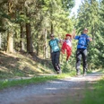
From Vormwald Station, you go up to the Rothaarsteig via hiking path X3. A few steps further, and Ginsburg, the first highlight of the route, is already reached. The ascent is worthwhile because there is a wonderful view over the snowy Siegerland at the top. Those who wish can already take a break here or at the nearby Hotel Ginsberger Heide. Through the Ginsberger Heide, a nature reserve with rare plant and animal species, the route continues towards Giller. Giller, at 653 m, is the highest elevation in this region. If you like, you can climb the Gillerberg Tower and enjoy the special view over the landscape. Those not completely free of vertigo also have a great view at the foot of the tower. Depending on the weather, you can also watch a beautiful sunset here. Continuing along the Rothaarsteig, the Lützel Station is reached after about 1.7 kilometers.

Good to know
Best to visit
Tour information
Stop at an Inn
Author
Katharina Schwake-Drucks
Organization
Touristikverband Siegen-Wittgenstein e.V.
License (master data)

Nearby