- 7:45 h
- 23.03 km
- 303 m
- 303 m
- 142 m
- 314 m
- 172 m
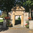
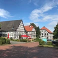
- Start: Rheder / church alternatively parking lot Weidenpalais
- Destination: Rheder/Church alternatively parking lot Weidenpalais
Free parking is available at the starting point at the church in Rheder. Alternatively, you can turn right at the end of Rheder after the brewery and park your car free of charge at the willow pavilion. Follow the main road towards Siddessen until you leave the village. Please follow the hiking trail on the left towards Hampenhausen through the settlement and then into the forest. During the ascent, you walk past the fish pond in Himmelreich and shortly before the village past the "Hummelwiese" (small cul-de-sac to the left) and the "Hartmann adventure farm" in Hampenhausen. The hiking trail leads you to the radar station on the outskirts of Auenhausen. From there, you cross the village of Auenhausen. Before you follow the hiking trail to Frohnhausen into the forest, you have the opportunity to follow the field path downhill for approx. 50 metres further along the edge of the forest. There you will find the so-called Kaiserstein. It commemorates the imperial manoeuvre of 9 - 12 September 1907, in which Kaiser Wilhelm II personally took part as a manoeuvre observer. Further on, you reach the village of Frohnhausen. On the ridge after the village you have a magnificent view. There is a sheltered rest area on the left of the path with a small spring pond in the background where you can take a breather. Before the old forestry worker's house, take a sharp right onto the field path. Passing fields and meadows, the path leads you downhill through a wooded area into the picturesque Nethetal valley. After leaving the forest, walk along the valley towards the village of Rheder. Once in Rheder, follow the main road back to the car.
Different paths/shortcuts are not maintained by the town of Brakel. The last section through the forest back to Rheder is currently being re-marked.Good to know
Pavements
Best to visit
Tour information
Cultural Interesting
Familiy-Friendly
Loop Road
Mainly Sunny
Suitable for Winter
Tour with Dog
Equipment
Directions & Parking facilities
From the A44 highway (Dortmund-Kassel), take the Warburg exit (continue in the direction of Brakel) past Peckelsheim, Niesen, Siddessen to Rheder. From Paderborn via the B 64 federal highway to the Brakel exit, onto the B 252, left towards Warburg.
Take bus line 550 from Brakel station to Rheder.
Additional information
www.brakel.de
tourist-info@brakel.de
Tourist Information, Am Markt 5, 33034 Brakel / Telephone no. 05272 - 360 - 1250
Contact person
Tourist Information Brakel
Author
Tourist Information Brakel
Organization
License (master data)
Tourist Information Brakel

Author´s Tip / Recommendation of the author
Map
Nearby