- 1:06 h
- 3.89 km
- 90 m
- 90 m
- 133 m
- 223 m
- 90 m
- Start: Parking lot at the meeting place "Alte Feuerwehr", Tiergarten 44, 33803 Steinhagen
- Destination: Parking lot at the meeting place "Alte Feuerwehr", Tiergarten 44, 33803 Steinhagen
If you do not follow the trail immediately at the next junction to the right, but instead follow the stalemate for about 50 meters, you will reach the beautiful confluence of the Jückemühlenbach and Schierenbeeke streams, which gives the trail its name.
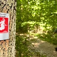
Back on the actual route, you can expect a varied hike through forests and along fields with some particularly beautiful views.
Tip: The Steinhagener Wanderpass and the sticker "Schierenweg" are available free of charge from the Hotel Steinhägerquelle and the town hall.
Good to know
Pavements
Best to visit
Directions
Tour information
Loop Road
Equipment
Directions & Parking facilities
Meeting place "Alte Feuerwehr"
Address for the navigation system: Tiergarten 44, 33803 Steinhagen
Take the 88, 188 or 68 bus to the "Vierschlingen" stop.
Then a short walk to the starting point of the trail.
Take the "Haller Willem" train to the "Steinhagen Bahnhof" stop.
Then walk along Bahnhofstraße in the direction of the L 756.
On reaching the L 756, turn left towards Halle (Westfalen)
After about 400 meters you will find the street "Tiergarten" on the left side with the starting point at the "Alte Feuerwehr"
Additional information
Contact person
Author
Organization
Gemeinde Steinhagen
License (master data)
Gemeinde Steinhagen

Author´s Tip / Recommendation of the author
Safety guidelines
Nearby