


- 3:00 h
- 22.92 km
- 166 m
- 166 m
- 55 m
- 171 m
- 116 m
- Start: Alfter
- Destination: Alfter
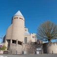
Alfter-Witterschlick-Impekoven-Alfter
Length: 22.9 km
Ascent: 185 m
Travel time: 3:00 hours
Good to know
Best to visit
suitable
Depends on weather
Tour information
Cultural Interesting
Loop Road
Stop at an Inn
Directions & Parking facilities
Parking lot at Alanus University, Witterschlick train station
Bus stop: Alfter/Alanus University (Line 18)Further entry points: Bf Witterschlick (line 23) , Bf Impekoven (line 23)
Additional information
www.apfelroute.nrw
Author
Rhein-Voreifel Touristik e.V.
Organization
Rhein-Sieg Tourismus
License (master data)

Map
Flyer Schleife Alfter
Nearby

