- Photos & Map
How would you like to arrive?
- Call
- Description
- Good to know
- Nearby
Download GPX file
- 3:43 h
- 13.78 km
- 262 m
- 262 m
- 245 m
- 342 m
- 97 m
- Start: "Priggersteich" directly at the sports field
- Destination: "Priggersteich" directly at the sports field
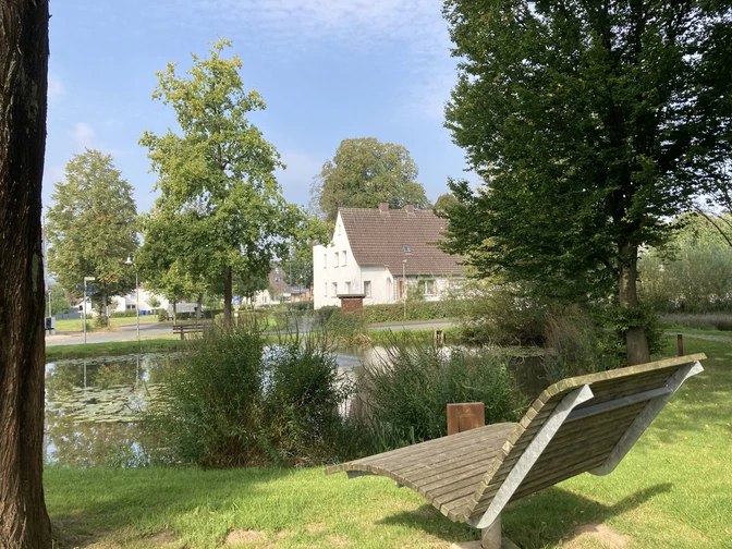
Schwaney, situated in a scenic location on the old Hellweg in the headwaters of the Eller, can look back on over 1,000 years of history. Nestled in an idyllic mountain basin, the village lies away from traffic, close to the European long-distance hiking trail E 1 and Eggeweg.
Just in time for the German Hiking Day 2015, the members of the Schwaneyer Eggegebirgsverein have marked out a new circular hiking trail in collaboration with the Altenbeken municipal administration. The challenging half-day hike takes you 13.5 km around Schwaney. Along the way, you will be rewarded with sweeping views of Schwaney, the Eggegebirge mountains and the Ellertal valley. Apart from two short sections, the path is paved throughout and is therefore also suitable as a cycle path.
Good to know
Pavements
Best to visit
Directions
Start and finish of the hike is "Priggersteich" directly at the sports field. From there, head towards the village center/church, then immediately turn left onto Heideweg and follow the signs for "Schwaneyer Panoramaweg". After approx. 1 km uphill, you will reach Station 1 "Lüppsteert". The name of the field is a reminder of a place where iron was mined in Schwaney. Until around 1880, miners dug and worked in the wooded area between the Saulweg and the path to the Emderwald forest. Adits up to three meters deep and 20 meters long can still be found today as a result of weathering and field work. Lüppsteert = Lüpp- or Luppenfeuer with which the iron ore was burned out of the stones. Steert = place, location, square.
At the end of the grassy path, keep right on the paved road and walk a short distance towards Schwaney. Then take a sharp left and follow the ascent to the highest point of the hike (342 m). After 2 km you reach station 2 "Lourdes Grotto". The grotto was built from Reels stone in 1939 and consecrated by Father Meyer on Trinity Sunday. The Madonna was cast in plaster by an artist in Düsseldorf. This place of "quiet contemplation" is looked after with much love and effort by the owners, the Rustemeier family and the people of Schwaney.
A good 500 meters further on, you can then decide whether to first make a small detour to the right to the fisherman's hut to take a break or immediately follow the path to the left. After a short, steep climb up the Happenberg (approx. 60 meters in altitude), you will reach station 3 "Fluggelände auf dem Hoppen- oder Happenberg". The name is derived from the cultivation of hops for beer production. Hops thrived exceptionally well on the southern slope. In January 1828, Schwaney citizens tried for the last time to obtain permission to brew beer - in vain. In good summers, grapes also ripened on the climatically favorable slope. Due to the good thermals from the rising heat in the Ellertal valley, model pilots and paragliders have been using the Happenberg as a training ground since the 1990s.
Back downhill you reach station 4 "Kriegereichen" (approx. 20 m to the left). In 1930, Pastor Oberreuter planted 72 oak trees in memory of the dead and missing soldiers of the First World War. He placed a massive oak cross in the middle of the oak grove, which has already been renewed several times. Father Oberreuter caught a severe cold during the planting work, from which he died a short time later as a result of pneumonia.A little later, you reach station 5 "Antoniusbildstock". After the old chapel from 1750 fell into disrepair, the community erected this wayside shrine on the same site in 1910 in honor of the popular saint Antonius. The stones of the chapel were used as the foundation. According to legend, a shepherd planted an elm tree on this spot around 1750, which had to be felled by the elm splint beetle in 1991. With a height of 32 meters and a trunk circumference of 5.82 meters, it was the mightiest mountain elm in the Paderborn district. St. Anthony of Padua, also known as Klüngelanton, is venerated here. Every year on 13 June, a procession leads here in honor of the saint.After another 2 kilometers, you will reach station 6 "Limberg". The Limberg is a rapidly rising ridge that runs as far as Buke. It has a height of 321 m at the water reservoir. A cast-iron cross has stood on the hilltop, also known as Hexenplatz, since 1891. The name Hexenplatz (witches' square) is reminiscent of a pagan place of worship or sacrifice. In his book "Schwaney - Zur Geschichte eines tausendjährigen Siedlungsraumes", Schwaney's honorary citizen and author Heinz Küting derives the Latin word "Limes" from the name Limberg: Wall, border wall or also border path. He also writes: "What gives the almost barren Limberge its special character is its strange structure. This unusual stepping of the mountain is by no means a natural product, but the work of human hands.The "Priggersteich" starting point is around 3 km away.
Tour information
Loop Road
Equipment
Directions & Parking facilities
From Paderborn, take the B64 and turn into Duhner Weg leading to Schwaney.
From the south, take the A33 to the PB-Zenrum exit and then take the B64. Alternatively, take the L817 and L828.
A bus stop overview can be found here.
Nahverkehrsverbund Paderborn/Höxter
Always know what's running: The smart number for buses and trains in NRW 01803 504030 (timetable information for €0.09/min from a German landline, mobile max. €0.42/min)
Author
Marion Wessels
Organization
Gemeinde Altenbeken
License (master data)
Map
Nearby


