- 1:09 h
- 4.78 km
- 8 m
- 8 m
- 79 m
- 88 m
- 9 m
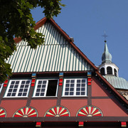
- Start: The church in Ostinghausen
- Destination: The church in Ostinghausen
This small low moor is primarily a magnet for birds. The 50-hectare site is one of the last remaining calcareous low moors in the region. The observation point allows good views of birds and of the impressive Water Buffalo, which keep the area open.
Good to know
Pavements
Best to visit
Directions
There is an observation post accessible at ground level in the eastern part of the area. From there, you can either go back the same way or return via the Woesteweg in the east of the area and the Loher Straße to Ostinghausen (about 4.2 kilometres).
Tour information
Loop Road
Equipment
Directions & Parking facilities
Address for satnavs: Kirchstraße 14, 59505 Ostinghausen (Bad Sassendorf)
GPS (UTM): 32 U 444490, 5720732
Google coordinates: 51.634941, 8.197505
Additional information
Located nearby, in the former moated castle of Haus Düsse, is the Agricultural Education and Research Institute (landwirtschaftliche Lehr- und Versuchsanstalt) with its adjacent small deciduous forest. This is reached via a footpath alongside the Ostinghausen sports field.
Author
Petra Salm
Organization
Arbeitsgemeinschaft Biologischer Umweltschutz im Kreis Soest e.V
License (master data)
Petra Salm

Author´s Tip / Recommendation of the author
Nearby