4-day hut hike from Bad Wiessee over the Blauberge to Spitzingsee


- 30:00 h
- 85.20 km
- 3,688 m
- 3,701 m
- 725 m
- 1,858 m
- 1,133 m
- Start: Bad Wiessee
- Destination: Bad Wiessee
Day 1: Bad Wiessee - Tegernsee Hut (Ross- and Buchstein) / Walking time: 5:30h, 788m ascent, 721m descent, 15.2km
Day 2: Tegernsee Hut - Gufferthütte / Walking time: 8:30h, 1213m ascent, 1401m descent, 22km
Day 3: Gufferthütte - Blecksteinhaus / Walking time: 9:00h, 845m ascent, 1293m descent, 27.5km
Day 4: Blecksteinhaus - Spitzingsee - Rottach-Egern - Bad Wiessee / Walking time: 8:00h, 746m ascent, 1001m descent, 23.9km
Good to know
Best to visit
suitable
Depends on weather
Tour information
Loop Road
Loop Road
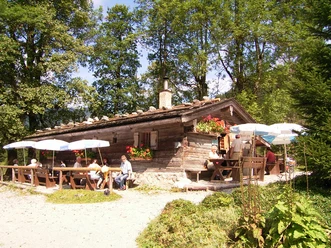
Stop at an Inn
Summit
Author
Regionalentwicklung Oberland
Organization
Alpenregion Tegernsee Schliersee
License (master data)

Nearby

Download GPX file