Barrier-free hiking trail from Grünheide to Morgenröthe - Rautenkranz


- 0:56 h
- 3.71 km
- 2 m
- 87 m
- 615 m
- 702 m
- 87 m
- Start: Waldpark Grünheide
- Destination: Space Exhibition Morgenröthe- Rautenkranz
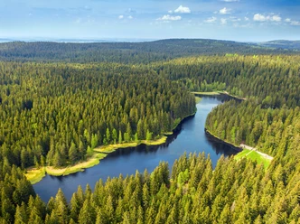
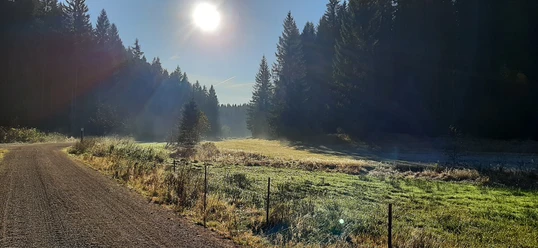
The hike from Waldpark Grünheide to the German Space Exhibition surprises the hiker with treasures of pristine nature and offers insight into space travel and space research at the end of the route.
Good to know
Best to visit
- suitableDepends on weather
Directions
The route we tested is 3.8 km long (one way). There are 98 meters of descent and 20 meters of ascent to overcome. Our well-trained "tester" completed the route without assistance. We recommend taking helpers along on the hike. If you plan to use the same route as the way back, strong friends are urgently required. If enough companions join the tour, the space exhibition can also be reached via the Tannenbergsthaler Weg towards Sieben Wege Kreuzung, then continuing via Sandiger Weg to Rautenkranzer Str. and further as described in our hike. This route is not recommended as a return path due to the steep climbs.
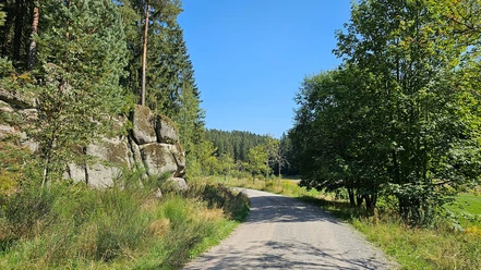
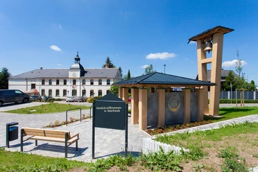
We start our hike at Waldpark Grünheide and follow the signposted Vogtland Panorama Weg towards Morgenröthe – Rautenkranz. The surface of Rautenkranzer Str., which we use, consists of a sand-slurried gravel layer. It caused no problems for our "tester." After about 1.6 km we pass the rock formation named Jungfernsprung. The Zinsbachweg coming from the left brings sediment mud onto our path during heavy rain, where assistance might be necessary. Shortly before reaching the village area of Rautenkranz, there is a 250 m long climb to master, reaching up to 7%. In the village area, the path is asphalted or paved with slabs. Via the street Am Filz, we reach federal road B283. Here we turn right onto the footpath (no lowered curb). Now we can already see the building of the space exhibition on the other side of the Zwickauer Mulde. We follow B283 to the bridge. There, we cross the Mulde and turn left into Bahnhofstraße.
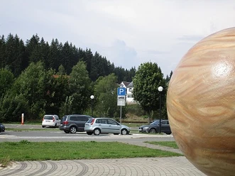
After about 300 m, we have reached the German Space Exhibition. The exhibition grounds are barrier-free (except for the MIR module).
Tour information
Cultural Interesting
Suitable for Pushchair
Equipment
- You don't necessarily need professional equipment for the route, but you should have basic gear with you (helmet, repair kit, weather-appropriate clothing, provisions, and drinking water).
Directions & Parking facilities
- Getting thereYou reach Grünheide via the A72 - Treuen exit. Then continue towards Auerbach and then to the Grünheide district.ParkingIf you arrive by private car, plenty of parking spaces are available at the forest park for travelers.Public transportationYou can arrive by Vogtlandbahn line VL1 Zwickau – Kraslice to Auerbach. From there, onward travel to Waldpark Grünheide by public bus is not possible. Taxis or special buses for group trips must be organized independently in good time. During stays at KIEZ, the staff are happy to assist with onward travel from Auerbach.
Additional information
Vogtländischer Knollenring e.V.
Schönecker Str. 35
08606 Mühlental OT Tirschendorf
info@vogtlaendischer-knollenring.deLiterature
More information can be found on the Vogtland Tourism Association's website at www.vogtland-tourismus.de or by calling 03744/188860, as well as at other tourist information points along the route.
Author
Tourismus Marketing Gesellschaft Sachsen mbH
Bautzner Straße 45/4701099 DresdenOrganization
Vogtland - Sinfonie der Natur
License (master data)
Vogtland - Sinfonie der Natur

Author´s Tip / Recommendation of the author
- Visit the German Space Exhibition in Morgenröthe-Rautenkranz. In Grünheide, you can use a barrier-free climbing path!
Safety guidelines
- Please assess your own fitness level and remember to carry enough drinks and a mobile phone with you.
Map
- Information about more routes and activities can be found on the active pages of the Vogtland Tourism Association at www.vogtland-tourismus.de