- Photos & Map
How would you like to arrive?
- Description
- Good to know
- Nearby
Download GPX file
- 2:55 h
- 42.78 km
- 110 m
- 114 m
- 138 m
- 213 m
- 75 m
- Start: Schützenplatz, 02625 Bautzen
- Destination: Schützenplatz, 02625 Bautzen
Bautzen - Teichnitz - Lubachau - Kronförstchen - Quatitz - Großdubrau - Crosta - Milkel - Jetscheba - Kauppa - Commerau - Göbeln - Spreewiese - Klix - Salga - Malschwitz - Kleinbautzen - Purschwitz - Litten - Bautzen
Good to know
Best to visit
Directions
Start is in Bautzen at Schützenplatz.
- You leave the parking lot and turn right at the information board onto Taschenberg street.
- At the "Vor dem Schülertor" intersection you turn right and reach Seidauer street via Gerberstraße and "Vor dem Gerbertor" over the Spree bridge.
- At "Gasthaus Krause" you follow Seidauer street to the right.
- At the Teichnitz junction, you leave Seidauer street and go under the highway towards Teichnitz.
- In the town, you turn left onto Neuteichnitzer street and follow it through fields and meadows to Lubachau.
- About 300 m after leaving the town, you turn right onto the first street, reaching Quatitz via Kronförstchen and Dahlowitz.
- In Quatitz, turn left, drive to the town exit and then follow the road-accompanying bike path to Großdubrau.
- In town, turn left into Kleine Bahnhofstraße and drive to Bahnhofstraße.
- Before leaving the town, turn right into Bahnhofsiedlung.
- At the end of the street, keep left on the road-accompanying bike path in the direction of Crosta.
- You cycle on Lomsker street through Crosta. A detour to the "Blue Adriatic" is worthwhile here,
- At Milkener Weg you turn right onto it and enter the UNESCO Biosphere Reserve "Oberlausitzer Heath and Pond Landscape".
- At the first field path junction, turn left onto it, follow the path to the first intersection and turn left again.
- Following the path to the first pond, turn right between the first and second pond, then immediately left again. You ride through the pond area and reach Milkel.
- In town, you continue straight on the street that becomes Kirchstraße. At its end, turn right into Schlossstraße, then immediately left past the castle.
- You meet the Frog Bike Path, which you follow to the right via Jetscheba to Spreewiese.
- Here you leave the Frog Bike Path to the right into Klixer street.
- Past Spreewiese Castle you reach Klix with its gliding airfield.
- Here you turn left into the main street towards Salga, then right into Malschwitzer street and follow it to Malschwitz.
- Past the village square, continue straight until you turn left into Kleinbautzener street.
- This leads you over Kleinbautzen and the highway to Purschwitz.
- Following the main road via Litten to Niederkaina, you meet the Saxon City Route, which you follow back to the starting point of the route.
Tour information
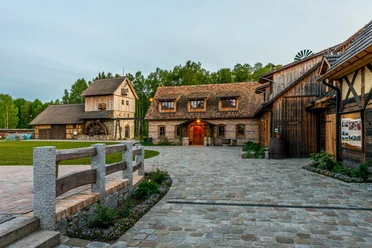
Cultural Interesting
Loop Road
Stop at an Inn
Equipment
Directions & Parking facilities
- Highway A4, exit Bautzen West
- Direction Bautzen center - Schützenplatz is signposted
- Schützenplatz parking lot (paid)
- Commuter parking Schliebenstraße (free of charge)
Please use the current and digital timetable information of the ZVON.
Additional information
Publisher (December 2020)
Bautzen District Office, District Development Office
Tel.: 03591 5251 61001
Tourist Information Bautzen-Budyšin
Hauptsmarkt 1, 02625 Bautzen
Tel.: 03591 42 016
Literature
This route and further route suggestions as pdf and gpx files as well as other offers in the region can also be found in the Geoweb at www.landkreis-bautzen.de
Author
OHTL e.V.
Organization
Das Landschaftswunderland Oberlausitz
License (master data)
Author´s Tip / Recommendation of the author
Sights:
- Quatitz: Memorial plaques at the school
- Großdubrau: Water tower around 1900, Margarethenhütte Electrical Porcelain Museum
- Milkel: Church, castle with park from the 16th century
- Klix: Half-timbered houses from 1835 - 1850
- Malschwitz: Niederhof around 1800
- Kreckwitz: Manor and park
- Niederkaina: Manor house around 1850
Safety guidelines
The route is not signposted.
Due to patchy network coverage, it is recommended to download the route before starting and, if necessary, use it offline.
Map
- SACHSEN KARTOGRAPHIE GmbH Dresden "Oberlausitz - Leisure Map"
- bikeline "Bike Map Oberlausitz"
Both maps are also available in the online shop of the Marketing Society Oberlausitz-Neiße region mbH.
Nearby


