- Photos & Map
How would you like to arrive?
- Description
- Good to know
- Nearby
Download GPX file
- 5:00 h
- 15.08 km
- 369 m
- 367 m
- 120 m
- 341 m
- 221 m
- Start: Krippen
- Destination: Krippen
When Dresden became a battlefield in March 1813 and the French ruler Napoleon occupied the city with 10,000 men, Friedrich decided to flee – to his beloved Saxon Switzerland. In the tranquil fishing village of Krippen, he found shelter in a friend's house. He was familiar with the picturesque surroundings and the variety of motifs that the area offered from previous visits.
A total of 12 information boards along the Caspar-David-Friedrich-Route display the drawings Caspar David Friedrich made at the respective locations. Highlights along the route include the Mittelhangweg, the Kaiserkrone, the path to the Wolfsberg where one can enjoy a very beautiful panorama with the Schrammsteine and the Zirkelstein, as well as the Caspar-David-Friedrich-Column in Krippen. A 13th information board is located on the Elbe cycle path in Krippen, a bit upriver from the brick shed on the Elbe cycle path, with views towards Bad Schandau and the Lilienstein.
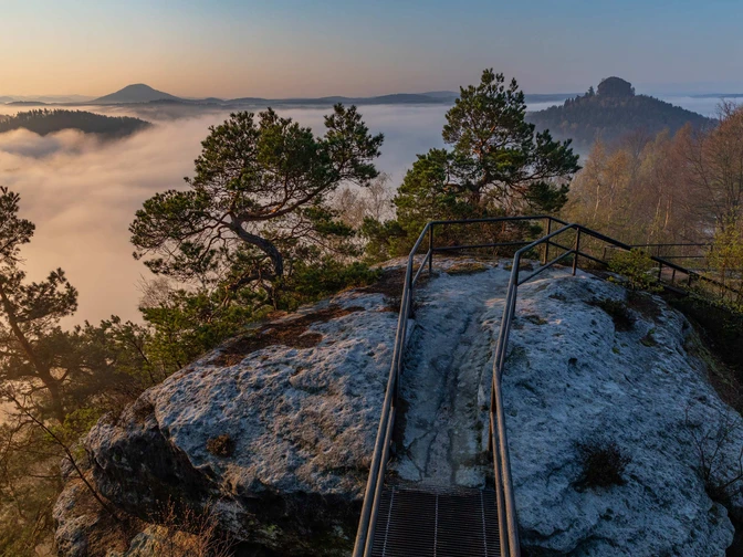
A special highlight of the route is the Kaiserkrone. At the foot of this table mountain, Friedrich made the delicate pencil drawing "Rocky Summit" on June 3, 1813. About five years later he returned to this and other studies to create an oil painting in his studio that would become his most famous work. The "Rocky Summit" is the rock on which the "Wanderer above the Sea of Fog" stands.
Good to know
Pavements
Best to visit
Directions
The Caspar-David-Friedrich-Route starts at a wooden information pavilion at the junction of Elbweg/Zum Mittelhangweg in Krippen. Here, information boards already provide interesting facts about Caspar David Friedrich. The path continues right along the street "Zum Mittelhangweg". Towards the rear of the street, it becomes less romantic as you reach a construction site of the German Railways near the railway tracks. Around 1813, when Friedrich himself was in this area, he also would not have found his usual beloved silence here. At that time, sandstone was being quarried in the Krippen quarries. This topic is also addressed by information board no. 2, located on the right just before a fork in the path. It is entitled "The Quarry Motif" and shows, among other things, a watercolor by Friedrich of a quarry near Krippen dated July 19, 1813. Right next to this information board, the path now leads up the slope to the Mittelhangweg. Upon reaching the top, follow the path to the left and after about 100 m you reach the actual site of the quarry motif discussed on information board 2. A signpost indicates the exact location. From here, the route continues gently for about 3.5 km along the Mittelhangweg to the Hirschgrund. Along this stretch are information boards 3-8. Highlights of this section include numerous views across the Elbe to the Schrammsteine. Caspar David Friedrich was also inspired by these views. Shortly after information board 7, on the left there is a picnic area with another magnificent view into the Elbe valley.
After information board 8, leave the Mittelhangweg, cross the Hirschgrund to the left over a bridge, and continue on the other side of the valley following the path to the left towards Schöna Castle. From the adjoining Elbhangweg you can repeatedly see Schmilka on the opposite side. After about 800 m the path meets the Malerweg. From here, the Caspar-David-Friedrich-Route and the Malerweg run together in parallel for a stretch to Reinhardtsdorf. A steep climb must now be overcome, going up the Aschersteig to Schöna. Upon reaching the top, you will be rewarded with a wonderful view of the Schrammsteine and into the Bohemian Switzerland. Also, the Zirkelstein and the Kaiserkrone line up southwards ahead. The latter is the next destination. The path continues straight across the field to the first houses of Schöna. There, when you reach the street in Schöna, watch carefully for the turn-off to the Kaiserkrone on the right. The ascent branches off somewhat unobtrusively between two houses. After the steps, you will find information board no. 9. The prominent rock at the Kaiserkrone, on which the "Wanderer above the Sea of Fog" stands, is visible at the foot of the Kaiserkrone, but the view today is partly obstructed by some trees. The climb up to the Kaiserkrone is well worth it. It is not too difficult, and at the top plateau there are various viewpoints with unique 360-degree views of Saxon and Bohemian Switzerland.
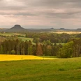
Back down, you follow the Malerweg again through the district of Schöna and take course towards the Wolfsberg. After leaving Schöna village, the path leads across a field past a small idyllic pond up to Wolfsberg. There, next to a rest area, is information board no. 10. Here too, there is a magnificent panoramic view of the Schrammsteine, the Zirkelstein, the Kaiserkrone, and into Bohemian Switzerland. From here, the path then leads down to Reinhardtsdorf and past the church back up to the Krippenberg. On the last stretch of the path, two more information boards follow.
Upon arrival in Krippen, the hike ends at the Caspar-David-Friedrich-Column, inaugurated in November 2023. Created by stonemason Jan Lorenz, the column commemorates the painter's time in Krippen. Inspired by historical signposts that once gave guidance to the artists of Romanticism, it marks the end of the hike.
Tour information
Cultural Interesting
Loop Road
Stop at an Inn
Equipment
Sturdy footwear required!
Note for winter: hiking poles and crampons that attach under the shoes can increase your personal terrain suitability in winter. This equipment can be purchased at the Tourist Service in Bad Schandau.
Directions & Parking facilities
Drive the A17 to the Pirna exit, then continue on the B 172 towards Königstein/Bad Schandau. Shortly before the Elbe bridge in Bad Schandau, turn right towards Krippen.
Small parking lot near the railway underpass, other small parking lots in town:
Parking lot behind the inn Zum Echtner (Elbweg 6A, 01814 Bad Schandau OT Krippen).
There is also a large parking lot in Reinhardtsdorf-Schöna (Waldbadstraße, opposite the tourist office). However, the route must then be hiked differently.
Arrival/Departure:
S-Bahn S1 (Meißen - Schöna) to Krippen station
Bus line 252 (Schöna - Bad Schandau - Schmilka), stop: Krippen - Alte Schule
Additional information
Tourist service Bad Schandau: 035022 90030
Here you can find more information about the life and work of Caspar David Friedrich in Saxon Switzerland
Literature
Order now: Hiking guide
Order the free information package "Caspar David Friedrich in Saxon Switzerland" here.
Author
Nicole Hesse / Tourismusverband Sächsische Schweiz e.V.
Organization
Tourismusverband Sächsische Schweiz
License (master data)
Author´s Tip / Recommendation of the author
If the entire Caspar-David-Friedrich-Route is too long for you, it can also be hiked in 2 individual stages here.
Option 1: Start in Krippen and hike along the Caspar-David-Friedrich-Route to Schöna to the Kaiserkrone (via the Mittelhangweg, Elbhangweg & Aschersteig). There, Bus 252 departs from the village square in Schöna back to Krippen or Bad Schandau. Most information boards (No. 1-9) are located on this route segment. Duration: approx. 3.5 hours
Option 2: Take Bus 252 to the village square in Schöna. Start hiking from the village square and follow the signs towards Wolfsberg. If you have not yet been to the Kaiserkrone (information board 9 – Rocky Summit), you should first make a detour there (about 10 minutes on foot) and then continue from there along the path to Wolfsberg. This route ends at the Caspar-David-Friedrich-Column in Krippen. There are 3 information boards on this stretch. Duration: approx. 2 hours
Visit the multimedia exhibition "CDFriedrich inspires" at the Haus des Gastes in Bad Schandau!
Safety guidelines
This is a red route (medium difficulty tour, with slight ascents, possibly difficult in deep snow).
Map
Buy here: Hiking maps
Nearby
