Hiking with four paws on the Malerweg

- 37:45 h
- 118.93 km
- 3,598 m
- 3,678 m
- 112 m
- 543 m
- 431 m
- Start: Liebethal-Pirna
- Destination: Stadt Wehlen
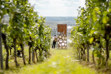
An inexhaustible abundance of bizarre rock formations, wooded, romantically wild gorges, and majestic table mountains with breathtaking views: All this is offered by the "Malerweg" in the Saxon Switzerland National Park. From the beginning, artists were particularly drawn to the picturesque rock formations. Follow in the footsteps of famous Romantic painters such as Caspar David Friedrich, Carl Gustav Carus, and Ludwig Richter. Experience the fascinating sandstone landscape of the Elbe Sandstone Mountains on this traditional hiking route from its most picturesque sides. Enjoy the numerous sights such as the Canaletto town Pirna or the house of the impressionist painter Robert Sterl in Wehlen-Naundorf, along with many inviting inns along the way.
Route start:
The hike can be started anywhere. Recommended start is at Liebethaler Grund
Trail marking:
Complete signage and constant monitoring, marked with its own logo
Character:
The Malerweg leads through gorges and secluded forest sections, past sandstone formations and impressive views.
Various sections offer magnificent panoramic views to the left and right of the Elbe with views of isolated table mountains.
Difficulty level:
easy to difficult, surefootedness required
Good to know
Pavements
Best to visit
Directions
1st stage (approx. 11.5 km / 4 hrs)
From Liebethal (Pirna) to Stadt Wehlen
This stage of the Malerweg should be easily manageable with a dog.
2nd stage (approx. 13.8 km / 5.5 hrs)
From Stadt Wehlen to Hohnstein
Bypass of the Wolfsschlucht via the Hohnstein nature trail.
3rd stage (14.0 km / 5.5 hrs)
From Hohnstein to Altendorf
This stage of the Malerweg is also unproblematic with a dog.
4th stage (19 km / 7.5 hrs)
From Altendorf to Neumannmühle
From Altendorf, descend through the Dorfbachklamm and take the left branch. This allows a comfortable hike to the Ostrauer Mühle. The Malerweg leads uphill via the Mühlweg and Bauweg onto the Elbleitenweg into the Schrammsteine. The Jägersteig ascent is bypassed via the Elbleiten- and Zeughausweg. The end of the stage is the Lichtenhainer Waterfall with a connection to the Kirnitzschtalbahn.
5th stage (13.6 km / 7 hrs)
From Neumannmühle to Schmilka
Hiking with a dog is possible on this stage.
6th stage (17.6 km / 7 hrs)
From Schmilka to Kurort Gohrisch
Also on the 6th stage, there are only difficulties for the four-legged companion on the Gohrischstein. To avoid the iron ladders, it is recommended to bypass the Gohrisch, which is possible in both directions.
7th stage (17.3 km / 6.5 hrs)
From Kurort Gohrisch to Weißig
From Kurort Gohrisch, the Muselweg, the Jagdsteig, the Königsweg, and the Alte Schulweg lead hiking enthusiasts to Pfaffendorf. To climb the Pfaffenstein, an alternative to the "Nadelöhr" ascent should be chosen at this point. Upon reaching the Pfaffenstein, both humans and dogs will enjoy a view of the legendary Barbarine, a landmark of the Saxon Switzerland. Towards Quirl, one can descend via the Klammweg. On the northeast side of Quirl, there is a large walkable cave called the Diebeshöhle, which is worth exploring. Via the nearby Latzweg, one reaches the foot of Königstein Fortress, which is also worth a visit with a dog, but sufficient time should be planned.
8th stage (13.6 km / 5 hrs)
From Weißig to Pirna
On the last stage of the Malerweg, the massif of the Rauenstein can be bypassed via the forest path. This leads to Wehlen-Pötzscha and Naundorf. In the Naundorf town center, the Malerweg leads to the König's Nose via former quarries and continues to Obervogelgesang. At this point, the S-Bahn can be boarded. From there, follow the Elbe Cycle Path towards Pirna, then turn right to reach the Canalettoweg, which leads into Pirna's town center.
Tour information
Cultural Interesting
Stop at an Inn
Tour with Dog
Directions & Parking facilities
All information on arrival can be found here.
Further information on parking can be found here.
Arrival/departure:
varies depending on the stage but central starting points are:
- Pirna: can be reached by S-Bahn S1
- Pirna train station is a 2 min walk to the central bus station (ZOB) from where numerous bus lines depart
Additional information
Book tip: Hiking with Dogs in the Elbe Sandstone Mountains - incl. Malerweg
Literature
Order now: Hiking guide "Hiking with Dogs"
Author
Madlen Rogge
Organization
Tourismusverband Sächsische Schweiz
License (master data)
Madlen Rogge

Author´s Tip / Recommendation of the author
This hike is also well-suited for people who have a slight fear of heights and/or want to avoid ladders.
Safety guidelines
Detailed stage descriptions: https://www.saechsische-schweiz.de/wanderungen/wandern-mit-hund-malerweg-pirna
Note diversions: https://www.saechsische-schweiz.de/malerweg/planung/aktuelles
Map
Nearby