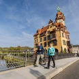
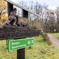
Circular hiking route around Döbeln

12.85 km long
Round trip
Difficulty: easy
Condition: very easy
Hiking
  • 3:30 h
  • 12.85 km
  • 201 m
  • 201 m
  • 162 m
  • 252 m
  • 90 m
  • Start: Döbeln main station
  • Destination: Döbeln main station
This circular hiking route guides you over heights and through valleys around Döbeln and promises nature experiences on the edge of the very green city.

The boot city Döbeln offers an extensive network of hiking trails approximately 55 kilometers in length. This circular hiking route leads over heights and through valleys around Döbeln and promises nature experiences on the edge of the green city. Especially popular are the two parks near the city center, Bürgergarten and Klosterwiesen. Along the hiking trail are two of the total 23 bridges and footbridges spanning the Freiberger Mulde. Various shops and different sights invite you to visit in the lively city center.

Good to know

Pavements

Unknown
Street
Asphalt
Gravel
Trail
Path

Best to visit

suitable
Depends on weather

Directions

Starting at the main station, the signed route leads through the underpass of the railway tracks to Mastener Street. Follow Mastener Street into town to the staircase at Bürgergarten. Through Bürgergarten to Waldheimer Street, then turn into Bärental Street and follow the signs to "Bärental". Walk through "Bärental", past the garden group "Schillerhöhe", cross the state road and continue following the markings that lead you through the "Butterbüchse" to Rößchengrund Street, which you follow to the left. Just before the small weekend settlement, turn right into Balkonweg and follow it to the forest "Roßweiner Anlagen". Take the paved path through the forest to the beginning of the "Roßweiner Straße" settlement. At the Döbeln town sign, cross this street and then follow the path along the Mulde River, past the sports field and fitness center, to the ship bridge. Here you cross the Freiberger Mulde and follow the signs through the residential areas Döbeln-East I and East II to Amselgrund. After crossing the dam, take the path first left and then right along the field edge northwards to Pommlitz. Now the hiking trail runs along Walter-Eckhardt Street to Holländerweg and then the nature trail along Leipziger Street. Crossing Leipziger Street to the Greiner settlement, follow the markings down to the Mulde cycle path. Follow the cycle path right, cross the Freiberger Mulde and turn left onto Grimmaische Street. Finally, keep right into Lindenallee until the destination point at the main station is reached.

Tour information

  • Loop Road

  • Stop at an Inn

Equipment

Sturdy footwear or sports shoes and weatherproof clothing, provisions and water if needed. Sun protection.

Directions & Parking facilities

• A14 (Dresden - Magdeburg) exits Döbeln-East and Döbeln-North

• A4 (Bad Hersfeld - Krakow) exit Hainichen (22 km via B 169) federal roads

• B 169 and B 175 (passing the city area)

Döbeln: Steigerhausplatz
  • Train: Döbeln main station
  • The Mitteldeutsche Regiobahn takes you on the RB 45 regional line hourly to Chemnitz, Riesa, or Elsterwerda.

    You can also reach Leipzig hourly by line RB 110.

Author

Verena Daser

Organization

LEIPZIG REGION

License (master data)

Verena Daser
License: no copyright required (Public domain) (no copyright)

Author´s Tip / Recommendation of the author

  • Bürgergarten
  • St. Nicolai Church with organ
  • Town hall with museum and Döbeln giant boot
  • Heckel House with gallery
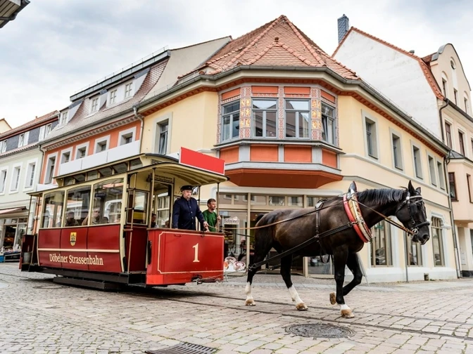
  • German Horse Railway Museum
  • Klosterwiese (monastery meadow)

Nearby
Contact

Circular hiking route around Döbeln
04720 Döbeln