


- 24:16 h
- 383.64 km
- 282 m
- 410 m
- 62 m
- 134 m
- 72 m
- Start: Ems Information Center Hövelhof
- Destination: Emden outer harbor
From the Senne on the edge of the Teutoburg Forest, the Ems Cycle Path winds its way to the North Sea. Along the way, it passes romantic forests that stretch along the banks of the Ems, pristine nature reserves with picturesque lakes, wide fields and pastures that stretch to the horizon and the lush green Ems floodplains that line the river for so many kilometers.
The approximately 385-kilometer EmsRadweg starts in Hövelhof at the Ems Info Center in the Senne and initially winds its way through the Paderborn region and the district of Gütersloh. The cycle path continues through Münsterland and Emsland to Emden in East Frisia, where the Ems flows into the North Sea. Along the way, you will experience the fascinating nature and beautiful landscape through which the river flows. Every now and then, the natural idyll is replaced by charming little towns with pretty half-timbered houses or romantic harbors.
The approximately 385-kilometer EmsRadweg starts in Hövelhof at the Ems Info Center in the Senne and initially winds its way through the Paderborn region and the district of Gütersloh. The cycle path continues through Münsterland and Emsland to Emden in East Frisia, where the Ems flows into the North Sea. Along the way, you will experience the fascinating nature and beautiful landscape through which the river flows. Every now and then, the natural idyll is replaced by charming little towns with pretty half-timbered houses or romantic harbors.
At just under 370 km long, the Ems is the shortest river in Germany.
Good to know
Pavements
Street
Asphalt
Gravel
Trail
Path
Best to visit
suitable
Depends on weather
Directions
The EmsRadweg is signposted in both directions throughout. The pictogram with the green wave shows you that you are on the EmsRadweg.
In between, simply follow the red or green arrows on the intermediate signposts.
Route markings
three green, wavy bars on a white background
Tour information
Familiy-Friendly
Good Connection to public Transport
Labelling
Nature Highlight
Possibility of Accommodation
Stop at an Inn
Suitable for Bike
Equipment
For better orientation we recommend the use of a GPS device.
Directions & Parking facilities
A33, exit 23-Stukenbrock-Senne, turn left towards Hövelhof, shortly afterwards follow the signs towards Emsquellen.
- Parking lot at the train station in Hövelhof - long-term parking free of charge in the Park&Ride parking lot.
- Public parking lot in Bahnhofstraße, 33161 Hövelhof. Free parking is available between the police station and the town hall - also for long-term parkers.
Hövelhof station
Additional information
Author
lokaler Redakteur
Organization
Teutoburger Wald Tourismus
License (master data)

Author´s Tip / Recommendation of the author
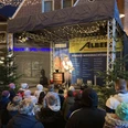
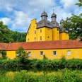
Taste Klosterbräu at Marienfeld Monastery!
Safety guidelines
Always pay attention to the road safety of your bicycle. For your own safety and as a role model, we recommend wearing a bicycle helmet.
Map
bikeline Radtourenbuch EmsRadweg
Scale 1:50,000 | 120 tear- and weatherproof pagesSpiral binding | Route description, city maps, accommodation list | ISBN: 978-3-7111-0062-7 | Price: 15,90 €
Scale 1:50,000 | 120 tear- and weatherproof pagesSpiral binding | Route description, city maps, accommodation list | ISBN: 978-3-7111-0062-7 | Price: 15,90 €
Social Media
Nearby


