From Bayrischzell to Osterhofen and back


- 2:00 h
- 5.58 km
- 45 m
- 45 m
- 783 m
- 826 m
- 43 m
- Start: Bayrischzell
- Destination: Bayrischzell
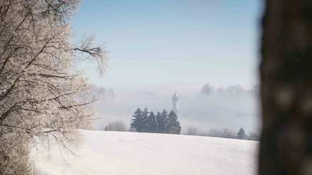
The circular route runs without many altitude meters at the foot of the Wendelstein in the Leitzach valley and is especially an experience when there is snow. Then not only walkers and hikers are out and about, since part of the route runs near the popular cross-country ski trail from Bayrischzell to Geitau. Places to stop and warm up are available along the way as well as at the start and end of the round trip.
Good to know
Best to visit
suitable
Depends on weather
Tour information
Familiy-Friendly
Loop Road
Loop Road
Stop at an Inn
Author
Regionalentwicklung Oberland
Organization
Alpenregion Tegernsee Schliersee
License (master data)

Nearby


Download GPX file