From Marienstein to the Rechelkopf


- 4:00 h
- 10.85 km
- 544 m
- 544 m
- 795 m
- 1,328 m
- 533 m
- Start: Marienstein
- Destination: Marienstein
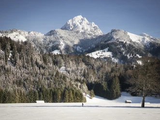
In suitable weather, this route leads through picturesque snowy forest and over meadows past some huts up to the Rechelkopf. Away from the bustling ski operations elsewhere, you can wonderfully slow down here.
Good to know
Best to visit
suitable
Depends on weather
Tour information
Summit
Author
Regionalentwicklung Oberland
Organization
Alpenregion Tegernsee Schliersee
License (master data)

Nearby