- Photos & Map
How would you like to arrive?
- Description
- Waypoints
- Good to know
- Nearby
Download GPX file
- 5:10 h
- 75.82 km
- 209 m
- 209 m
- 95 m
- 183 m
- 88 m
- Start: right-bank Elbe parking lot in Meissen, directly on the Elbe
- Destination: right-bank Elbe parking lot in Meissen, directly on the Elbe
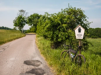
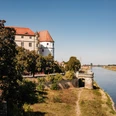
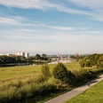
The route starts at one of the centrally located parking lots in Meissen and already offers an impressive view of the cathedral and the Albrechtsburg Meissen at the beginning. Upon leaving the city, an extensive open landscape opens up, which belongs to the Nassau landscape protection area. After crossing the protected area, you reach the first outskirts of Weinböhla with a wide view over the fields. At the Grutschenteich pond, the route branches off onto a beautiful, natural path until you finally reach Weinböhla.
The route continues through Weinböhla, passing the VELOCIUM, the Saxon bicycle experience world. Here, among other things, a pump track awaits everyone who wants to improve their riding technique. Then it goes over the town hall square towards the station and to the northeastern settlement edge of Weinböhla. At this point, the landscape opens up again, giving the view of gentle hills and vineyards that are typical for the region.
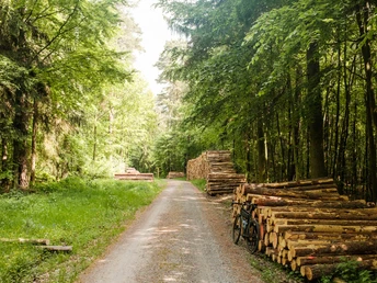
The tour now leads through the Friedewald on a bright forest path, one of the largest forest areas in Saxony. On varied path surfaces, it continues along a creek to the Gellertberg. Here is a small former hunting lodge, the today 'Gellerthäuschen,' an artificial ruin of a tower built in 1824, and the open-air stage which is still the site of various events. From here, there is a wonderful view far to the south and west over the vineyards, the Nassau, and the Spaargebirge mountains.
The journey continues to the Waldbad Oberau, where a stop in summer provides refreshment. Past the campsite, the route now leads into the open forest and meadow landscapes of the Moritzburg pond area. Especially tranquil are the Heidehofteich, Köckritzteich, and Silberteich ponds. This section is very scenic and offers some short, flowy passages – a real highlight for all who want to experience nature from the saddle and enjoy technical challenges.
Finally, the route leads to Moritzburg, known for the impressive hunting and baroque castle. The route then winds further through the forest area, passing numerous sights such as the charming Fasanenschlösschen, the only historical lighthouse in Saxony, and the game reserve, a gem for native animals.
Those who want to take a break can make a detour to the impressive castle or discover further cultural highlights such as the historical Saxon state stud farm, the Käthe Kollwitz House, the Red House, or the signposted BRÜCKE route. Moritzburg thus offers not only a break for body and mind but also many opportunities to experience the rich history and culture of the region.
Afterward, the route goes back through the Friedewald on forest and service roads. Here, you pass the wolf monument, which commemorates a driven hunt of Elector Johann Georg I in 1618. You pass the Dippelsdorfer pond landscape, where the eponymous Dippelsdorfer pond is circled.
The route then leads through the forest and further directly through the town of Coswig, past sights such as the Folprecht blue-dyeing factory, the 'Old Church,' one of the most beautiful preserved Saxon village churches from 1497, and the Karrasburg museum, a gem full of historically significant treasures.
The last kilometers back to Meissen run along the Elbe cycle path, past the bathing lake in Coswig-Kötitz, which also invites you for a refreshing cool-down on warm days, making it the perfect reward after a beautiful and varied ride.
Surface conditions:
28.0 km asphalt, 3.1 km road, 15.3 km gravel road, 26.1 km natural path
moderate and asphalted climbs, forest paths well maintained
Waypoints
Good to know
Pavements
Best to visit
Directions
From the starting point parking lot, you ride straight ahead over the "Elbberg" to Meissen station. Here you follow Dresdner Straße and turn into Zaschendorfer Straße after about 350 m. Opposite the speedway stadium, turn right into Heinrich-Heine-Straße. Behind the tax office, leave this street again, turn into Altzaschendorf street, and continue straight ahead to Auenstraße, where you leave Meissen city limits.
You cross the railway tracks and continue straight on to Mittelweg. On this path through the protected area, you cross the "Gabenreichbach" and turn right after about 800 m onto Schwarzen Weg, which briefly follows the "Pechgraben." Continuing straight ahead, you reach Niederauer Grenzgraben and continue on Viehweideweg. After a few meters, the route leads right into Ehrlichweg in Weinböhla.
However, the tour does not yet enter the city but instead turns back right onto Mittelweg. At the first intersection, turn right again into Zaschendorfer Weg and follow it to Grutschenteich. Here the route turns left onto Neuer Rutschweg and after a few meters turns left again onto Tiefen Weg. Follow this path to the Weinböhla stop.
Here, briefly turn right into "An der Nassau" street and immediately leave it to turn left onto Dresdner Straße. At the Sachse bakery, turn right into Rathausstraße, passing the VELOCIUM bicycle experience world. Upon reaching the town hall, follow the path semi-left over the town hall square to Hauptstraße, turn right, and shortly after turn left into Bachgasse. Follow this street to Sachsenstraße and turn right again. At the next intersection, the route branches left into Schindlerstraße, leading to the station, where the route turns left and crosses the tracks through an underpass.
After the railway underpass, turn left onto Berliner Straße, which continues into Grenzstraße. Follow this until you reach "Am Waldacker" street, turn right, and pass through a small settlement. At the first fork, turn left onto a forest path.
The route follows along the creek "Preßgrundwasser" and passes the Gellertberg on the left. After Gellertberg, leave Preßgrund and reach an intersection where you turn left. After a short section, the route meets Forststraße, which you follow to the right. Shortly thereafter, the road veers slightly left. Here, stay on the path "Am Gemeindebad" and pass the campsite and Waldbad Oberau. The tour then continues straight through the forest.
After some time, you reach Großteich pond. Behind it, turn right onto another forest path. At the next fork, keep left until the route again turns right at another intersection. Then follows a longer section straight ahead without turns. Only at Mistweg do you turn right again and follow it. At the junction with O-Weg, leave Mistweg turning left and continue on O-Weg. After about 700 m, the route turns right and makes two left turns, passing the Hubertus riding stable (Reiterstübchen restaurant) to H-Weg. From here, you reach O-Weg again, which you follow left. Turn right at the first intersection and follow LW-Weg to S81, which is crossed straight ahead.
LW-Weg continues through dense forest until you reach Zehnweg. Here, keep left to then turn right at the next fork onto Am Heidehofteich path. The route continues toward Neuteich pond, visible from afar. However, the route passes right in front of Neuteich and continues straight to Furtteich pond.
Behind this pond, turn left and reach Köckritz- and Silberteich ponds. Between both waters, continue on X-Weg before the route turns right to circle Silberteich.
After Silberteich, continue straight to Hämmerchen Weg, turn right. Later, cross F-Weg, turning left into it and follow it to Naunhofer Straße. Turn right here and at the next fork, keep right again to reach Kalkreuther Straße. The route passes Bauerteich pond on the right and continues to Mittelteich pond. Just before Mittelteichbad Moritzburg, turn left onto Neubauernweg and follow it along Frauenteich pond.
After crossing Radeburger Straße (S80), continue straight into Zum Teichhaus path. This path leads alongside Großteich pond, past the game reserve and Fasanenschlösschen to Bärnsdorf. Behind the railway tracks, turn right into Straße zum Großteich and follow it to Cunnertswalder Straße. Here, turn right again, pass Großteich pond to Cunnertswalde. The road then merges into Erik-Mallick-Weg and then straight ahead at Jägerteich pond into Volkersdorfer Straße to Moritzburg.
You pass through the town on Waldstraße, cross Schlossallee, continue straight on Schließerstraße and Brauhausstraße up to Meißner Weg, where you leave Moritzburg. After crossing the K-Weg (Meißner Straße/S80), continue straight on HC-Weg, which finally turns left into Steinernen Weg. At the next fork, keep right and follow HW-Weg to S81, which is crossed again.
Then the route goes straight into F-Weg to Moritzburger Straße/S80 towards Weinböhla. You cross this and take the left path towards Wolfsdenkmal and Lobetanzwiese. Here turn left again to the fork with X-Weg. Follow this right and briefly right onto Moritzburger Straße at the forest house Kreyern, then left again onto X-Weg. At the large fork with R- and L-Weg, take the 2nd path left to the next large intersection and turn left onto L-Weg. On this path cross S81 and continue straight on Steinernen Weg to the next fork. Turn right here and after about 600 m, turn right again at the 2nd intersection.
After about 900 m, the route leaves the forest. Keep left here and after about 300 m, right again to reach Eisenberger Weg at Dippelsdorfer pond. Leave this path immediately to the left and follow meadows and field paths, always keeping right, past Holzpferd again to Moritzburg to Kötzschenbrodaer Straße. Turn right and follow straight until it becomes a field path again. At the next fork, turn left and after 200 m right again towards Dippelsdorfer ponds. Before that, turn left, cross the railway tracks of Lößnitzgrundbahn straight ahead, pass the Bad Sonnenland campsite, and turn right at the parking lot. Continue straight on this path to Dippelsdorf.
In Dippelsdorf, keep right onto Großenhainer Straße, pass through the town straight ahead until Großenhainer Straße becomes Kreyernweg. Follow Kreyernweg straight out of town. You cross S81 again and then turn left into the forest onto Gabelweg.
Follow Gabelweg straight ahead, past Seerosenteich pond and Hohen Stein, to Coswig. In Coswig, Gabelweg becomes Hohensteinstraße, which you follow straight through town. At the beverage market, turn left onto Johannesstraße. Follow this to the 2nd intersection and continue straight onto Lutherstraße. Passing Peter-Pauls Church, the route then turns left over Pestalozzistraße, right over Johann-Sebastian-Bach-Straße, left onto Dresdner Straße, and after about 250 m again left onto Kötitzer Straße, which you follow straight to the Elbe.
At the Kötitz ferry house, turn right onto the signposted Elbe cycle path and follow it back to the starting point in Meissen.
Tour information
Cultural Interesting
Loop Road
Stop at an Inn
Directions & Parking facilities
From direction Dresden/Berlin:
Access via A4, exit Dresden/Altstadt and via B6
Several free parking spaces in the surroundings (e.g., parking lot at the Elbe).
By train:
S-Bahn 1 from Bad Schandau via Dresden
By bus:
Bus 401 from Coswig
Bus 404 from Cossebaude
Bus 407 from Nünchritz
Bus 409 from Großenhain
Bus 411/421 from Weinböhla
Bus 413/414 from Tanneberg
Bus 415 Löbsal
Bus 416 from Lommatzsch
Bus 418/412 from Nossen
Bus 422/417 from Ziegenhain
Bus 426 from Naustadt
Bus 428 from Wildsdruff
Bus 446 from Riesa
Timetable information | VVO-Navigator - Your mobility portal for Dresden and the region
Author
Dresden Elbland Redaktion
Organization
Dresden Elbland
License (master data)
Safety guidelines
Important notes that must be observed before riding:
The gravel bike routes published here are purely digital route recommendations. Riding is at your own risk. We accept no liability for accidents of any kind, including forest-typical hazards (e.g., falling branches, tipping trees, unforeseeable obstacles on the path). Please always ride attentively and with necessary caution. Be sure to observe local notices and regulations.
Our recommendations for safe and considerate gravel biking:
1. Use only existing paths and do not leave the recommended route. This protects nature and prevents erosion.
2. Respect other path users: Be considerate towards hikers, other cyclists, and riders. Yield right of way and communicate kindly.
3. Always adjust your speed to the respective conditions: Consider your riding technique, path conditions, weather, and other users.
4. Protect animals and nature: Stay on the paths, avoid rides at dusk or night, keep your distance from wildlife, and do not leave any trash.
5. Take your rubbish with you: Everything you bring – from packaging to tissues to spare parts – belongs back with you.
6. Wear appropriate equipment: Helmet, lighting, tools, spare parts, possibly provisions and enough water belong to the standard equipment.
7. Plan ahead: Check weather and path conditions, pay attention to your bike and equipment – and inform yourself in advance about the route.
Nearby
