Harzer Försterstieg


- 16:10 h
- 58.73 km
- 1,191 m
- 1,085 m
- 261 m
- 620 m
- 359 m
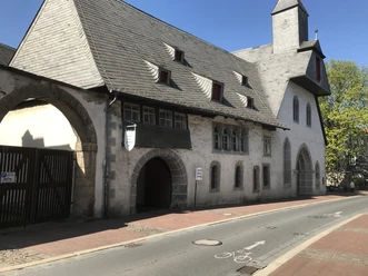
- Start: Goslar, Kaiserpfalz
- Destination: Riefensbeek-Kamschlacken, Kohlungsplatz
The Harzer Försterstieg runs from the historic imperial city of Goslar via Wolfshagen, past the mining towns Lautenthal, Wildemann and Bad Grund to the highlands around Clausthal-Zellerfeld. It leads southward past Buntenbock and Lerbach to Riefensbeek-Kamschlacken near Osterode. It borders three important reservoirs of the West Harz: the Granetalsperre, the Innerste reservoir and the Sösetalsperre.
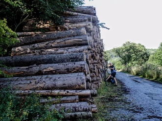
The hiking trail is marked by numerous viewpoints and connects essential elements that characterize the West Harz: a rugged landscape diversity, different types of forests and biotopes, historic mining, water use and flood protection as well as careful and sustainable timber use combined with the conversion of unsuitable tree stands.
The trail largely incorporates the historic "Innerste Rennstieg", which was already used in the Bronze Age for the transport of goods and communication transmission.
Good to know
Best to visit
Tour information
Cultural Interesting
Stop at an Inn
Author
Harzer Tourismusverband
Organization
Harz: Magische Gebirgswelt
License (master data)

Nearby