- 5:30 h
- 16.34 km
- 439 m
- 300 m
- 112 m
- 264 m
- 152 m
- Start: Bad Iburg, Tourist-Info
- Destination: Steinegge observation tower (or Dissen-Bad Rothenfelde, railroad station)
The stage begins at the historic castle in Bad Iburg and ends at the viewing tower on the Steinegge near Dissen. The route heads east along the Hermannsweg. This section is particularly attractive in the first half of the year: In March/April, the early-flowering larkspur can be seen along the edge of the path, allowing you to revel in a sea of flowers. You can then enjoy the fresh green of young beech trees on the Freeden near Bad Iburg. After a short, steep climb, the ridge path runs above the town of Hilter. A bridge takes you over the A33 before you reach wooded areas again. There is one last descent and ascent before you reach your destination. You can reach the town center of Dissen and the Dissen/Bad Rothenfelde train station via the Dissen access path.
Tip: If you have the time and inclination, you should definitely plan a visit to the treetop walk before the start. The treetop walk offers over 30 adventure and learning stations and an impressive viewing platform over the Teutoburg Forest.
Break tip: After a short hike, you will reach the first beautiful rest and viewing point shortly after the Freedenhütte waypoint.
2. Length of the stage in kilometers / altitude difference / route character
The stage is 16 kilometers long in total and has an altitude difference of around 500 metres. Evenly distributed over the stage, the route climbs quite steeply 3 times. The route is challenging due to the steep climbs and leads through wooded sections.
3. Scenic features
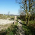
Along the stage, wooded sections alternate with steep slopes and gentle hills. The route along the edge of the forest offers wonderful views of the valley to the south.
Highlights on the route
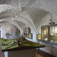
- The historic Iburg in Bad Iburg is one of the town's most important sights. It was built in the 11th century on the ruins of an old castle and is still the town's landmark today. The castle complex, which is situated on a mountain spur, once served as a bishop's seat and the magnificent 17th-century knights' hall has been preserved to this day. The castle offers impressive views of the surrounding area and is located in the middle of the pretty old town of Bad Iburg.
- The Noller Schlucht is a natural rocky gorge. The path through the gorge is accessible as a hiking trail and offers beautiful views.
- The lookout tower on the Steinegge near Dissen offers a panoramic view of the Teutoburg Forest. The tower is 61 meters high and has a viewing platform at a height of 25 meters.
A good alternative interactive tour map of the stage can be found here:
Good to know
Pavements
Best to visit
Directions
We recommend the following quality establishment in Hermannshöhen:
- Bad Iburg:HOTEL IM PARK, Tel. 05403 788380, www.hotelimpark.de
- Dissen:
Hotel im Eventhaus Schamin, Tel , 0176-62240435, www.eventhaus-schamin.de
Tour information
Familiy-Friendly
Nature Highlight
Possibility of Accommodation
Premium Trail "Wanderbares Deutschland"
Stop at an Inn
Tour with Dog
Equipment
Directions & Parking facilities
Parking lot at the Schlossmühle
Charlottenburger Ring 46, 49186 Bad Iburg
directly along the way
Bus stop Bad Iburg, Rathaus465 Osnabrück-Bad Iburg-Glandorf
466 Osnabrück-Hilter-Dissen-Bad IburgParking lot Rathaus Bad Iburg
Arkadenstraße 5, 49186 Bad Iburg
directly on the wayBus stop Bad Iburg, Rathaus
465 Osnabrück-Bad Iburg-Glandorf466 Osnabrück-Hilter-Dissen-Bad Iburg
Timetable informationHiking parking lots with local transport connections en route:
Wanderparkplatz zum Freeden
Zum Freden 50, 49186 Bad Iburg
directly on the wayBus stop Bad Iburg, Rathaus
465 Osnabrück-Bad Iburg-Glandorf466 Osnabrück-Hilter-Dissen-Bad Iburg
FahrplanauskunftEntrance opposite Eppendorfer Weg 1, 49176 Hilter aTW
approx. 650 mBus stop Hankenberge Ellerweg
466/467 Osnabrück-Bad Iburg-Hilter-DissenWanderparkplatz Noller Schlucht
Rechenbergstraße 100, 49201 Dissen aTW
direkt am WegBus stop Nolle, Noller Schlucht
309 Bad Rothenfelde - Dissen - Nolle - Melle419 Dissen - Nolle
The smart number for bus and train in NRW:
Electronic timetable information: 08006 - 50 40 30 (free of charge)
OWL Verkehr GmbH: 05231/977 681
Bus timetable information online: westfalentarif.de
Additional information
Contact person
Ms. Ina Bohlken
Author
Ina Bohlken
Organization
Projektbüro Hermannshöhen
License (master data)

Author´s Tip / Recommendation of the author
Safety guidelines
Our recommendations

Nearby