Hiking - Moos circular route


- 3:00 h
- 12.14 km
- 104 m
- 104 m
- 621 m
- 688 m
- 67 m
- Start: Hiking car park Murnauer Moos on Ramsachstraße
- Destination: Hiking car park Murnauer Moos on Ramsachstraße
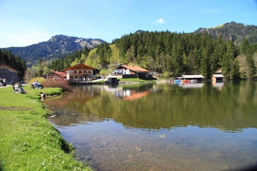
Whether shrikes, quail kings, or European adders, whether carnivorous sundew, Siberian iris, bug orchids, or the scepter flower, in the Murnauer Moos – the largest contiguous and largely original moor area in Central Europe – there is still a great wealth of plant and animal species that have long since disappeared elsewhere. In the Murnauer Moos, large areas of hay meadows, lowland and transitional moors, spring funnels, old waters, and residual lakes combine with fully developed raised bogs into a complex of habitats with many rare and endangered species.
Good to know
Best to visit
suitable
Depends on weather
Tour information
Loop Road
Loop Road
Stop at an Inn
Author
Simon Bauer
Organization
Naturpark Ammergauer Alpen e.V.
License (master data)
Simon Bauer

Nearby


Download GPX file