


- 4:30 h
- 16.19 km
- 349 m
- 478 m
- 362 m
- 561 m
- 199 m
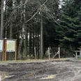
- Start: Birkenbrauck hiking car park
- Destination: Stertschultenhof Cobbenrode
The Birkenbrauk hiking car park is very suitable as a starting point for the Sauerland-Höhenflug as well as for the Esloher Grenzgänger.
The hiking taxi (for holders of the Schmallenberger Sauerland Card) starts at the Eslohe bus station in the town center, where parking spaces are available, and takes you in a short time to the Birkenbrauck hiking car park.
Start: Saturdays at 11:00 a.m. and Sundays at 10:00 a.m. at the Eslohe bus station
Booking the hiking taxi: Until at the latest 5 p.m. on the previous day at Taxi Fabri under 02973 / 81414. Please also book dogs.
Destination: Stertschultenhof in Eslohe-Cobbenrode.
Good to know
Best to visit
Directions
Follow the hiking sign Esloher Grenzgänger. For this, cross the street at the hiking car park through the forest to Hoppen-Kreuz. From here, turn left downhill through the Buchwald forest to the street, which you follow along Schloss Obersalwey to the village. In the village, go right past the chapel through the Romke valley, always uphill to Fretterspring.
Enjoy the magnificent view on the hiking path above the Bat Tunnel to the Galle, where the road connects the two villages of Kückelheim and Serkenrode. The path now leads uphill with a view of the small village Dormecke and the Rothaar Mountains in the distance. Shortly after reaching the Buchenhagen hiking car park, you hike left on the C3 through Obermarpe further up to the Stertberg and then down to the Stertschultenhof.
Equipment
Please wear sturdy footwear and bring sufficient provisions and drinks.
Directions & Parking facilities
This route is ideal for guests from Cobbenrode who travel by bus to Eslohe in the morning to the starting point of the hiking taxi.
Alternatively, hikers from other places have the option to return by bus from Cobbenrode to Eslohe after finishing the hike.
Free parking is available at the shooting hall or at the church in Cobbenrode.
There are also free parking spaces at the bus station in Eslohe.
Use the hiking taxi from the bus station in Eslohe (Saturday & Sunday, for holders of the Schmallenberger Sauerland Card) to the Birkenbrauck hiking car park.
Public transport conveniently brings you from the surrounding villages Wenholthausen (Bus 367), Reiste (Bus S70), and Cobbenrode (Bus R68) to the starting point of the hiking taxi at the Eslohe bus station.
Guests with a valid Schmallenberger Sauerland Card use public transport free of charge!
Information about the Schmallenberger Sauerland Card: www.sauerland-card.de
Public transport timetable information: www.rlg-online.de
Author
Tourist-Information Schmallenberger Sauerland
Organization
Schmallenberger Sauerland Tourismus
License (master data)

Safety guidelines
A rescue point system is installed in the Hochsauerland district. Rescue points can be found, among other places, on the information boards at the junctions and hiking signs.
Map
We recommend the hiking map of the Eslohe holiday region at a scale of 1:25,000
Nearby