Holzkirchen impressions: market run route


- 3:15 h
- 13.08 km
- 54 m
- 56 m
- 682 m
- 737 m
- 55 m
- Start: Holzkirchen station
- Destination: Holzkirchen station
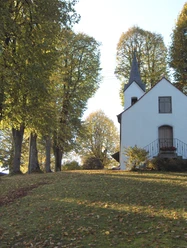
Not just a running classic - the route of the annual Holzkirchen market run is suitable as a nice walking route in transitional seasons, with an urban start followed by a high proportion of greenery. Thanks to its path along local roads, field paths, and forest trails, it is also passable with strollers.
Good to know
Best to visit
- suitableDepends on weather
Tour information
Familiy-Friendly
Loop Road
Loop Road
Suitable for Pushchair
Author
Regionalentwicklung Oberland
Organization
Alpenregion Tegernsee Schliersee
License (master data)

Nearby


Download GPX file