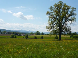
Through Holzkirchen's groves and fields


- 4:30 h
- 17.58 km
- 139 m
- 139 m
- 681 m
- 768 m
- 87 m
- Start: Holzkirchen Station
- Destination: Holzkirchen Station
With this walking route from Holzkirchen, you have a nice extended stroll on not too difficult paths; the route is also suitable for all-terrain air-tyred strollers, although the length of the route should not be underestimated. Short sections of the route run along state and federal roads, but the majority of the route is traffic-calmed and relaxed to walk. The route is ideal in the transitional season to simply get some exercise or to test your hiking fitness for longer tours.
Good to know
Best to visit
- suitableDepends on weather
Tour information
Familiy-Friendly
Loop Road
Loop Road
Stop at an Inn
Suitable for Pushchair
Author
Markt Holzkirchen Standortförderung
Organization
Alpenregion Tegernsee Schliersee
License (master data)

Nearby

Download GPX file