


- 11:40 h
- 46.48 km
- 544 m
- 548 m
- 52 m
- 354 m
- 302 m
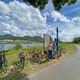
- Start: Niederdollendorf station (Königswinter)
- Destination: Niederdollendorf station (Königswinter)
Good to know
Best to visit
Directions
From the starting point it is just a few meters to the Rhine. For the next 12 km you follow your nose without obstacles to the traditional wine village of Unkel. If needed, you can gather strength during a short break here for the steep climb to the Rhine terrace, 50 m higher. There, romantic avenues enchant you. The challenging ascent is quickly forgotten and you are ready to climb the 150 m higher Asberg on the following gravel straights through the forest. From there, you speed down into the Pleistal. The black gravel mountains on Nonnenberger Straße bear witness to the last basalt quarry left in the Siebengebirge at Hühnerberg. From there, you pedal with more power along open field paths to climb the small Ölberg again. Afterwards, a gravelly descent to the monastery lies ahead: Siebengebirge at its best. Now you are ready for a final challenge: the Dollendorfer Hardt – forest at the back, vineyard in front. After the quick vineyard ride, you reach your starting point through a small street with half-timbered houses.
Tour information
Loop Road
Stop at an Inn
Equipment
Gravel, mountain, or trekking bike
Directions & Parking facilities
Niederdollendorf station (Königswinter), RB 27 / RE 8
Author
Tourismus Siebengebirge GmbH
Organization
Rhein-Sieg Tourismus
License (master data)

Author´s Tip / Recommendation of the author
Rest in the Siebengebirge at the Waidmannsruh inn
Nearby


