- 2:00 h
- 19.70 km
- 176 m
- 244 m
- 149 m
- 301 m
- 152 m
- Start: Nossen
- Destination: Leuben
The Ketzerbachtalweg begins in the town of Nossen and leads through the picturesque Ketzerbach Valley to Leuben. Right at the start of the tour, you’ll see the impressive Pöppelmann Bridge, originally built in 1715 and located below Nossen Castle, which in turn traces its origins back to a 12th-century fortress. Once you’ve crossed the bridge over the Freiberger Mulde, you’ll find the historic Volksbad on your left, which offers a welcome chance to cool off in the summer.
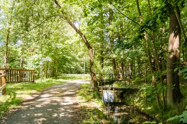
As you continue on, you’ll leave the city behind and immerse yourself in the peaceful countryside of the Ketzerbach Valley. In Radewitz, it’s worth taking a detour to the Radewitzer Höhe. After a short climb, you’ll be rewarded with a fantastic panoramic view of the Elbe region. You can also visit the monumental tomb of a local farming family, which offers an interesting glimpse into regional history.
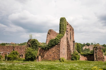
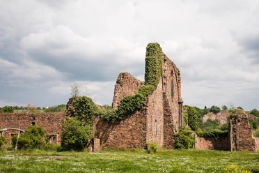
The route continues to Raußlitz, known for its church and the former manor estate with its charming manor house. These historic buildings invite you to take a short break and explore.
In Ziegenhain, a visit to the historic fortified church is highly recommended. Further along, the route passes the Graupziger Niedermühle mill and the impressive 300-year-old oak tree in the forest right next to the Ketzerbach stream.
The tour then continues to its final destination in Leuben. Right at the entrance to the town, another highlight awaits— the local train station. Here, the locals have worked together to breathe new life into the old station and regularly host events and concerts, including a former steam locomotive in the garden that evokes a sense of nostalgia and makes for a great photo opportunity. St . Mary’s Church in Leuben is open to visitors, and Schleinitz Castle, about 2 km away, is also worth a detour.
Pavements
- Unknown (98%)Street (2%)
Best to visit
- suitableDepends on weather
Directions
- The bike tour begins in Nossen, below the castle at the Pöppelmann Bridge. From there, the route follows Dresdner Straße out of town across the Freiberger Mulde River, then turns left past Kronberg and out of the city. On the K802, after the highway underpass, turn left toward Ilkendorf.
In Ilkendorf, turn left at the first intersection and, after 100 meters, turn immediately right toward Radewitz. At the intersection there, continue straight ahead and follow the signs to Radewitzer Höhe. After Radewitzer Höhe, take the same route back into the village and then
turn
right onto Radewitzer Straße.
In the next village, Saußlitz, turn right and follow the signs to Raußlitz/Ketzerbachtal. In Raußlitz, turn onto Hermann-Schaeffler-Straße. After passing the church, turn left onto the K8051/Oberstößwitzer Straße and continue to Oberstößwitz. There, turn right onto the K8075/Pinnewitzer Straße to reach Pinnewitz.
In Pinnewitz, stay on the K8075/Ziegenhainer Straße, then turn left onto Wiesengrund and follow the forest path—or the continuation of Höfgener Straße—to Ziegenhain. There, turn left onto Kirchstraße and, after passing the church, keep to the right to follow the river along Graupziger Straße and reach Obermühle. After the mill, turn left briefly and then immediately right again, continuing along the stream until you reach Leuben. At the entrance to the town, Bahnhofstraße leads to the center at Lommatzscher Straße, which marks the end of the route. From here, you can optionally take bus line 420 back to Nossen (note: on weekends, this is only available as an on-demand bus—see “Getting There”).
Tour information
Cultural Interesting
Equipment
- The route is suitable for touring bikes, gravel bikes, and e-bikes.
Directions & Parking facilities
- Getting thereTo get there, take the A4 and exit at Wilsdruff, or take the A13 from Berlin.
Follow the B101 from Meissen or the B175 from Döbeln to reach Nossen.
ParkingParking:at the Nossen Market
Seminarweg
Grüner Weg
Public transportationDirections by public transportation (starting point: Nossen):Bus line 425: from Wilsdruff
Bus line 424 (PlusBus): from Dresden
Bus line 420: from Lommatzsch
Bus line 750: from Döbeln and Freiberg
Bus lines 412 and 418 (PlusBus): from Meissen
Bus stop: “Markt, Nossen”
Departure by public transportation (terminus: Leuben):
Bus Route 417: Toward Meissen and Lommatzsch
Bus line 420: toward Nossen and Lommatzsch
Bus line 427: toward Lommatzsch
Stop: “Gasthof, Leuben”
Note: On Saturdays and Sundays, scheduled buses from Leuben operate only as on-demand buses. Registration is required at least 60 minutes before departure (by phone or online).
Tel. 03521 / 74 16 63
www.vg-meissen.de/verkehrsmittel/anruflinienbus
Literature
Author
Dresden Elbland Redaktion
Organization
Dresden Elbland
License (master data)
Dresden Elbland Redaktion

Safety guidelines
- Be careful when going up and down Radewitzer Höhe; the path is unpaved and rocky.
Map