- Photos & Map
How would you like to arrive?
- Call
- Description
- Good to know
- Nearby
Download GPX file
- 20:23 h
- 70.09 km
- 1,613 m
- 1,614 m
- 69 m
- 278 m
- 209 m
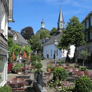
Starting point of the hike: Solingen Gräfrath
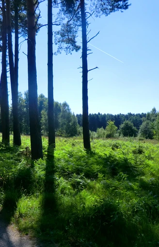
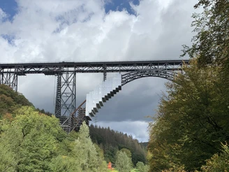
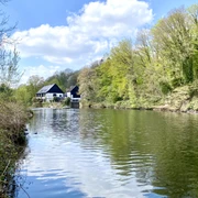
From Solingen Gräfrath, follow the white in a circle on a black background across the Gräfrather Heide down to Friedenstal. The route heads along the slopes of the Wupper to Kohlfurth in Solingen and from there on towards the Müngsten Bridge. If you want to, you can go down to the Wupper here and stroll through the Brückenpark Müngsten or take a break at Haus Müngsten.
Via the Brückenpark Müngsten and the Sengbach reservoir to Balkhauser Kotten
The trail continues through the Brückenpark in the direction of Solingen Unterburg, but then turns sharp left again and winds its way up the southern slopes of the Wupper and down into the Eschbach valley.
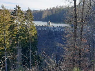
Across the Eschbach, follow the Sellscheider Bach in the direction of Wermelskirchen. After crossing the big main road, however, the trail heads via Angerscheid down to the Sengbach reservoir, which you can see from the trail every now and then. Further down the valley, you will reach Glüder. The route then heads up to Pfaffenberg. The Balkhauser Kotten grinding museum is nestled picturesquely below on the river Wupper. You can stop here if you like and then join the Klingenpfad again after the Balkhauser Kotten.
From the Wupper back to Solingen Gräfrath via Ohligser Heide
From Balkhausen, the Klingenpfad reaches the city limits at Leichlingen, but immediately swings back to the city area of Solingen passing Haus Hohenscheid. On the Schellenberger Weg, the route heads via Bünkenberg in a wide arc along the banks of the Wupper towards Rüden.
If you want to, you can continue down the bank of the Wupper and cross over to Rüden. The Klingenpfad, however, runs above the picturesque timber-framed village to Mühlenberg.
After a final stop at the historic Wipperkotten, the Klingenpfad stops following the course of the Wupper and winds its way through the Aufderhöhe district of the city to Ohligser Heide. This offers a nice contrast to the forested Wupper slopes. The trail leads through the city past the Solingen Vogel- und Tierpark. Then it descends into the Itter valley to the outskirts of Haan. The course of the Itter eventually leads the Klingenpfad back to Solingen Gräfrath.
Good to know
Best to visit
Tour information
Familiy-Friendly
Labelling
Loop Road
Multiday Tour
Possibility of Accommodation
Contact person
Stadtmarketing Klingenstadt Solingen
Author
Lilian Möntmann, bearbeitet/übersetzt: Supertext/Home of Translation GmbH
Organization
Bergisches Land Tourismus Marketing e.V.
License (master data)
Nearby
