Königstein: Via Thürmsdorf to the Bärensteine


- 4:15 h
- 10.80 km
- 330 m
- 330 m
- 177 m
- 313 m
- 136 m
- Start: Königstein Fortress parking garage | Am Königstein stop (to the fortress)
- Destination: Königstein Fortress parking garage | Am Königstein stop (to the fortress)
Parking garage of Königstein Fortress - Thürmsdorf - Götzinger Cave - Kleiner Bärenstein - Großer Bärenstein - Thürmsdorf Castle - Malerweg chapel - forest brook - parking garage Königstein Fortress
Good to know
Pavements
Unknown (1%)
Asphalt (18%)
Trail (32%)
Path (49%)
Best to visit
suitable
Depends on weather
Tour information
Loop Road
Loop Road
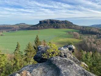
Summit
Author
Yvonne Brückner
Organization
Tourismusverband Sächsische Schweiz
License (master data)
Yvonne Brückner

Nearby


Download GPX file