L2 - Local hiking trail Bad Laasphe "Banfetal and Wartholzkopf"
- 4:00 h
- 13.91 km
- 324 m
- 324 m
- 320 m
- 587 m
- 267 m
- Start: Hiking map Wilhelmsplatz hiking portal Bad Laasphe (town center)
- Destination: Hiking map Wilhelmsplatz hiking portal Bad Laasphe (town center)
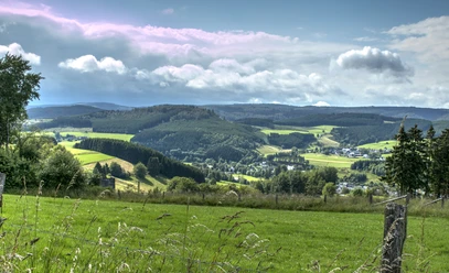
Initially, flat, still asphalted sections through green pastures are soon replaced by steady climbs, offering wonderful views that are no less impressive than the impressive wind turbines that roar high up on Wartholzkopf above Wittgenstein region.

Good to know
Best to visit
suitable
Depends on weather
Tour information
Loop Road
Loop Road
Author
Petra Markus
Organization
Touristikverband Siegen-Wittgenstein e.V.
License (master data)

Nearby
Download GPX file